March 27th, 2024
Introduction
On March 27th, 2024 students from the Environmental Geology class at Vancouver Island University visited Huddlestone Beach (Lantzville) as well as Piper’s Lagoon Park (Nanaimo), on Vancouver Island (B.C.), under the supervision of Professor Tim Stokes. During the visit, the daily temperature was 6 ℃ and the sky was cloudy with light rain. The goal of the field trip was to better understand the challenges of living in this region, specifically the issue of shoreline erosion and its protection. Climate change disturbs the global mean sea level by adding volume of water to the oceans in two ways, through the melting of ice sheets and glaciers, and by warming the water temperature leading to its expansion. Prior to the visit an investigation of both sites was completed using Google Earth, the Landowners Guide to Protecting Shoreline Ecosystems and Green Shores for Homes (Credit & Rating System, 2015), Passivhaus (An Introduction, 2012), and Green Building in Canada. During the visit field notes with observations about material types, shoreline protection measures, and Green Building construction characteristics were collected.
Background
In Nanaimo, climate change brings higher temperatures, wetter winters, and drier summers. In 2022, the City of Nanaimo Council adopted City Plan, which is a plan with a number of policies to help support the City adapt to Climate Change. Climate change adaptation strategies can be found throughout City Plan and included two new Development Permit Areas for Sea Level Rise and Wildfire Mitigation to help guide and protect new development from future climate hazards. A development permit (DP) allows City staff to review proposed developments to ensure they meet the policies and objectives of the Official Community Plan as well as the City’s environmental, heritage, and design guidelines. There are nine Development Permit Areas in the City, which serve various purposes including: the protecting the natural environment, ensuring that development considers hazardous site conditions, and ensuring the form and character of development follows relevant design guidelines (The City of Nanaimo, 2023).
In 2018, the Province of BC adopted an amendment to the Flood Hazard Area Land Use Management Guidelines that incorporated new building standards for coastal areas that consider relative sea level rise (RSLR) to 1.0 metre by 2100. The City’s Sea Level Rise Study (Study) was completed in 2019 and is a high-level vulnerability assessment of the City’s coastline. This Study includes sea level rise projections for 2050 and 2100; an assessment of potential coastal erosion impacts and defines a Flood Construction Level (FCL) along the City’s shoreline for 2050 and 2100. Results from this Study indicated that low-lying areas along the coastline are vulnerable to sea level rise, and specifically Departure Bay, Duke Point, Protection Island, and portions of the Downtown (The City of Nanaimo, 2023).
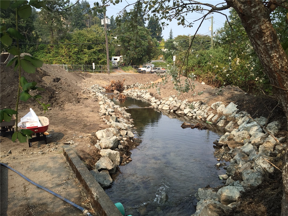
The restoration of a Property’s riparian area was completed in 2020 for shoreline stabilization and erosion control. The property lies on shoreline adjacent to the City of Nanaimo Piper’s Lagoon Waterfront Park, located in the NE part of Nanaimo. Shack Island lies just offshore of this property and provides shelter from the prevailing winds off the Strait of Georgia. Unique patterns of ocean current and abundant use of the foreshore by waterfowl also characterize this site. The low bank beach is gently sloped with sand and cobble-sized material. The overall site is within an intact Garry Oak ecosystem, and the property includes some Garry Oak trees recognized as Significant Trees under the City of Nanaimo’s Management and Protection of Trees Bylaw 2013 (No. 7126) (preserved during the development). The main objective of the project was to remove the bulkhead and restore the foreshore with natural materials and native vegetation to stabilize against erosion and create shoreline habitat. The restoration project removed a concrete bulkhead with a wooden fence attached to the top and a previously used septic system. The entire riparian area was regraded using existing beach materials and tidal function was fully restored through removal of the bulkhead. Large woody material was retained, and small boulders and new stumps and logs were placed higher on the slope to protect the shore through dissipation of wave energy (The Stewardship Centre for British Columbia, 2021).
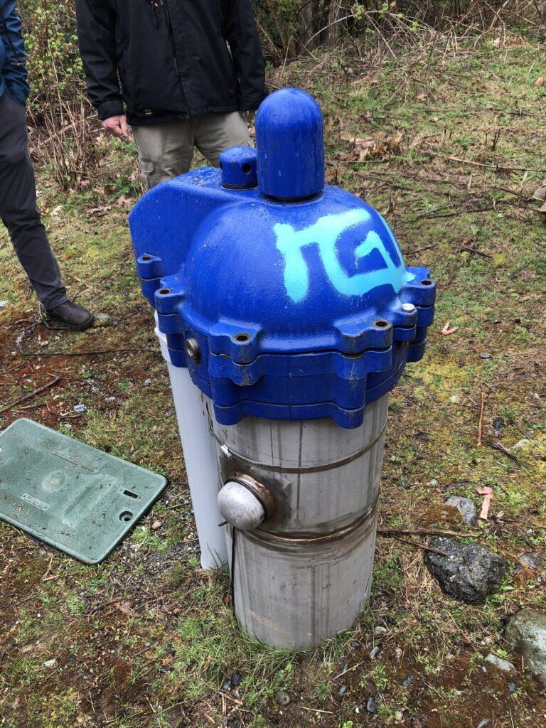
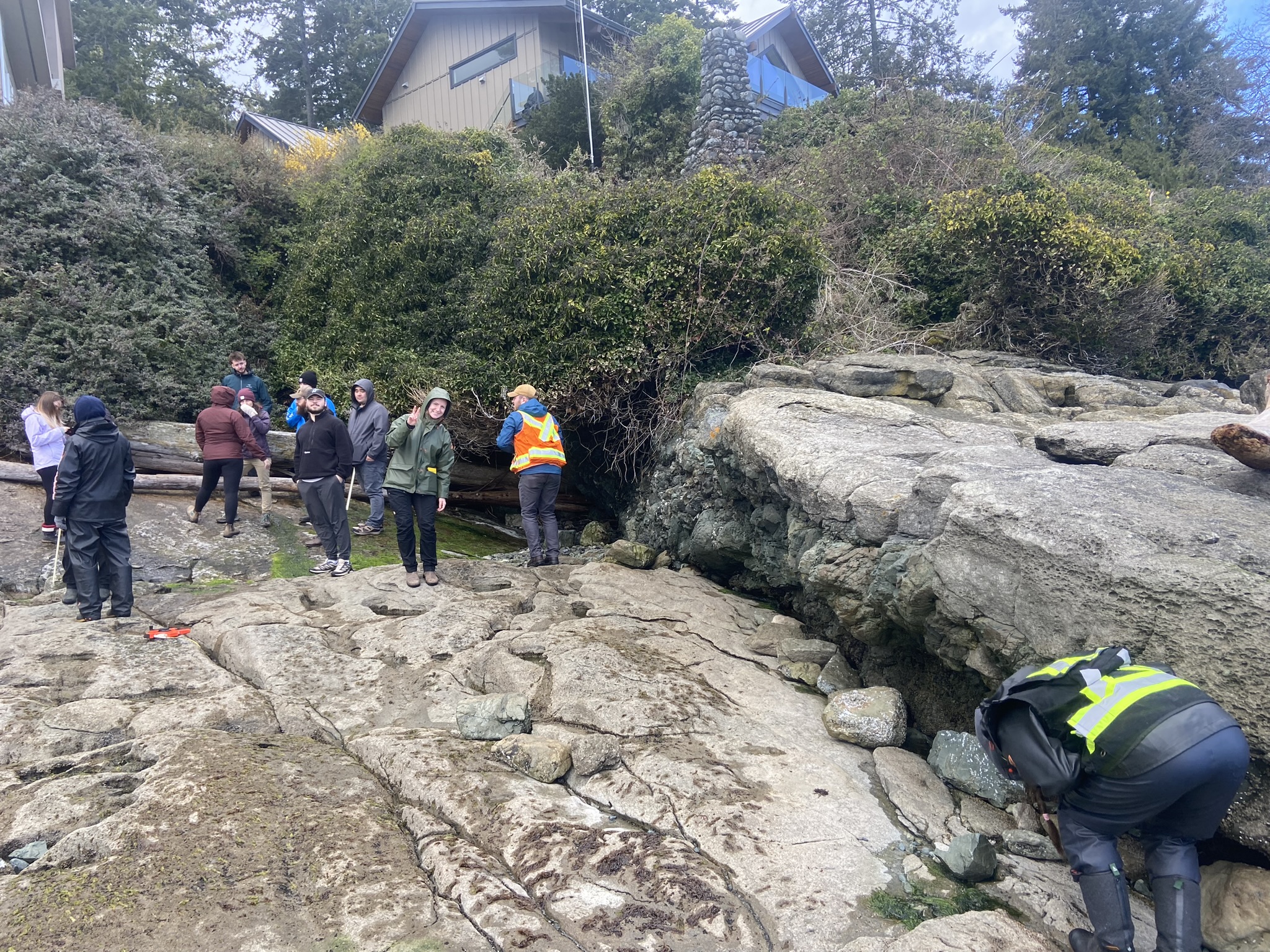
Notes and Observations
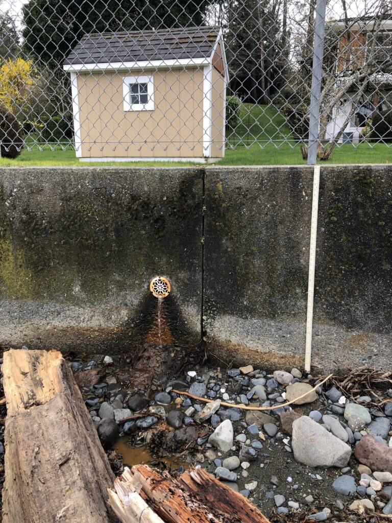
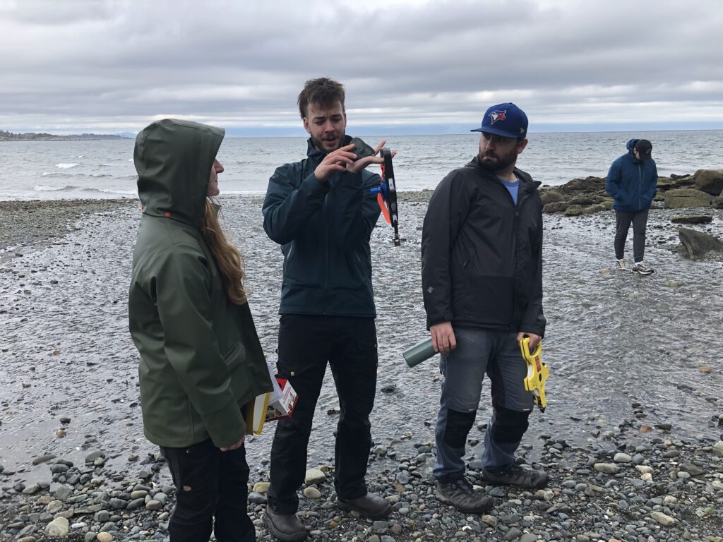
The material type at Huddlestone Beach (Lantzville) is cobbly sand. Evidence of shoreline erosion due to wave energy paired with unconsolidated sediments can be observed. The shoreline shows signs of sediments loss (especially at the base of the scarp) and a beach scarp at height of about 0.80-0.40 m is observed. Signs of erosion are apparent at the base of an old concrete wall, a riprap, and a pile of coal waste materials through materials loss. The old concrete wall is made of concrete embedded with rounded cobbles (height is about 1.2 m) and is eroded at the contact between the level of the tidal waves and the shoreline (erosion height about 0.30 m). A recently installed 0.80 m high and 100 m long concrete wall is installed eastward of the beach. The concrete wall has drainage installed (at 0.50 m in height) and suggests that the high tide line is about 0.25 m. The beach has some cobbly sand with mostly rounded cobbles, some coal and large logs deposited almost parallel to the shoreline. A lot built on coal waste piles has the most severe signs of erosion, and some concrete “pillows” are attached with rods to the shoreline (at 0.10 m in height).
Aspects of Green Building constructions incorporated at the Eby road property are the planting of vegetation on the beach scarp, and the installation of large wood logs on the beach to mitigate erosion and promote ecological resilience. Additionally, hard stabilization methods such as a riprap, concrete walls and concrete “pillows” with rods are used to decrease erosion of the shoreline.
Figure 1. The 100 m concrete bulkhead with drainage systems eastward of Huddlestone Beach.
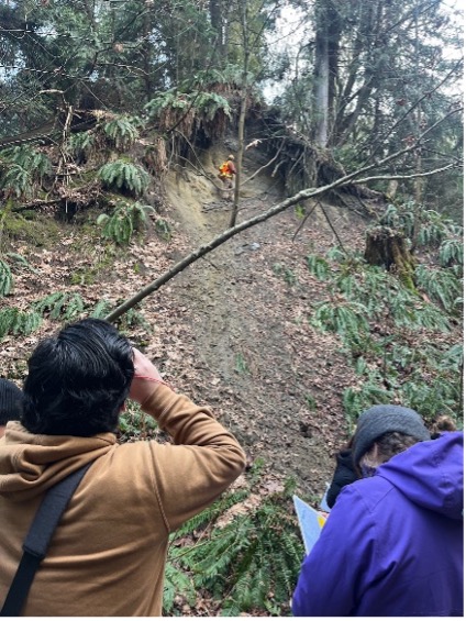
Figure 2. A trio of passionated young students easily impressed by beach sediments.
Conclusion and Recommendations
All things considered, the best method to mitigate shoreline erosion is the restoration of the beach riparian area to its “natural” state paired with a concrete bulkhead at the beach scarp with a drainage system, and logs on the beach. This would increase resilience to storm events, provide habitat to ecosystems, reduce erosion, and moderate wave action. The concrete bulkhead has a long lifespan and requires simple repair, and the restoration lower environmental impact at the shoreline. Depending on the future rate of sea level rise, building a seawall to prevent the impact of storm surge flooding and floods might be necessary but its trading off the intertidal zone for infrastructures safety.
References
The City of Nanaimo. (2023). Green Initiatives. Retrieved from https://www.nanaimo.ca/green-initiatives/climate-adaptation
The City of Nanaimo. (2023). Property and Development. Retrieved from https://www.nanaimo.ca/property-development/development-applications/development-permits
The Stewardship Centre for British Columbia (SCBC). (2021). Green Shores Case Studies (Piper’s Lagoon, City of Nanaimo, British Columbia). Retrieved from https://stewardshipcentrebc.ca/pipers-lagoon-city-of-nanaimo/