First Field Trip
January 10th, 2024
Introduction
On January 10th 2024, Vancouver Island University students, in the Environmental Geology (GEOL312) class, completed a field trip at Colliery Dam under the supervision of Professor Tim Stokes . The purpose of this field trip was to collect and report on a real-life environmental issue, using information gathered during the visit and available reports. The group met at the parking lot entrance of Colliery Dam (parking located by Lower Dam) with Euan Wilson and Mike Squire. Mike Squire is the Manager of Water Resources for the City of Nanaimo and both Euan and Mike updated the group about recent monitoring and investigations at Colliery Dams. The group walked from the parking lot to the Lower Dam then to Middle Dam, where the group were shown the spillway and the levee installed to help control the release of water downstream. The data collected on the field trip were information provided by both Euan and Mike.
Background
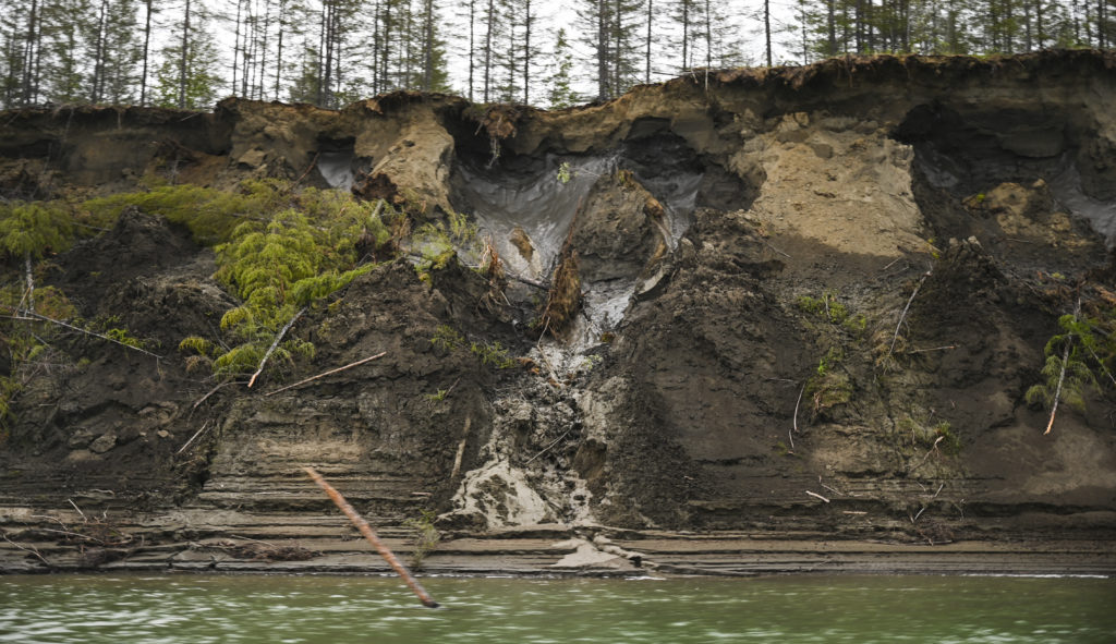
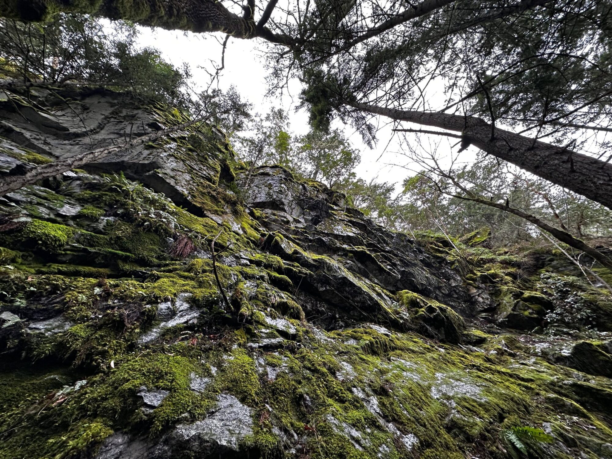
Colliery Dam was built in 1910-11 by the Western Fuel Company to supply water for coal washing. The Middle Dam show an exposure of sandstone and Colliery Dams is underlain by the Nanaimo Group deposits. The Colliery Dams park included forested areas, waterfalls, bridges and streams.
Colliery Dam Park is a popular destination for summer freshwater swimming and is home to three dams with high to very high risk of failure. Should the dams failed, the most important risk is from a seismically induced dam failure, likely to result in significant risk to downstream areas from the impounded volume of water upstream of the Lower and Middle Dams. Currently both structures (Lower and Middle Dams) are classified as Very High Consequence, due to population locate in the downstream floodplain areas and neither of those dam meeting the expected level of performance for flood or seismic safety, where both considered to be a level of risk outside the acceptable risk using generally applied standards (EBA, 2010). Possible consequences of the dams failure are loss of human life and their pets, destruction of residential and public structures, destruction of ecosystems on the floodplain and their species, and damage in the range of 40 millions dollars (Associated Engineering, 2012).
Notes and Observations
WMC’s investigation indicated that both the Middle and Lower Dams spillways have inadequate capacity either for the PMF or 1000-year return period event, with overtopping of the dam crests likely. Also, the Lower Dam spillway has inadequate capacity for the 100-year event, but the Middle Dam spillway have adequate capacity for the 100-year return period flood event. Induced failures are possible and the studied possibilities are: a 100-year return period flood event (overtopping failure of the Lower Dam only), 1000-year return period flood event (overtopping failure of both the Middle and Lower Dams in a cascade sequence (Middle Dam fails first leading to the immediate failure of the Lower Dam) with both the Middle and Lower Dams breach hydrographic peaks assumed to coincide, and finally a PMF event (overtopping failure of both dams in a cascade sequence where the Middle Dam fails first leading to immediate failure of the Lower Dam) and both the Middle and Lower Dams breach assumed to coincide. Overall, if the Middle Dam fails first it will result in a cascade failure of the Lower Dam (Associated Engineering, 2012).
A 100-year return period seismic event is estimated to result in a higher number of causalities than the Probable Maximum Flood (PMF) which has an approximately probability of a 10,000-year return period event. The dams high risk hazard assessment is based on the results of the 2012 Chase River Dam Breach Flood Inundation Study. Both the Middle and Lower Chase River Dams were constructed circa 1910/1911, making them 100 years old. The construction practices of that period are one of the major factors in the degree of concern regarding the safety of those Dams from both a seismic and flood risk perspective. All those Dams are composed of an internal concrete core, with a shell of fill material placed on either side of the core. EBA’s “Seismic Hazard Assessment Middle and Lower Chase Dams” of April 2010 provides the dam’s construction details, including uncertainties regarding ,and probable elements of their construction are: the concrete cores are almost certainly unreinforced with their construction quality poor in nature (compared to current practices), the concrete is potentially honeycombed and its core walls are known to contain cold joints, original fill materials were end dumped and hand placed ( no mechanical compaction), likely lenses of coarse and fine material in the original dam fills,
both dams had wood stave low level outlets penetrating the fills and concrete
cores, over time the wood stave conduits would rot (increase possibility of seepage failure) (Associated Engineering, 2012).
Conclusion and Recommendations
To mitigate the risk, in 1980, the City undertook significant work on both dams to address the low level outlets, where the valve chamber and low level outlets on the Lower Dam were filled with concrete, eliminating this source of concern on the Lower Dam (the low level outlet was not successfully located on the outside face of the Middle Dam), the lower shell on the Middle Dam was replaced with compacted fill composed of pit run sand and gravel (replacing the questionable original fill material, except on the left abutment (looking downstream) (Associated Engineering, 2012).
There is a 40% chance during a 50-year period that the dams will fail as a result of a seismic event and that damages would be in the range of $40 million (2012 dollars). The floodplain has many buildings including schools, family residential homes, a large school, a daycare, apartment, and commercial buildings. The flood zone also contains major transportation corridors including Highway 1 and the E&N Railway, and an estimated population (based on the 2011 census data) of 1883 inhabitants (Associated Engineering, 2012).
Euan and Mike, stated that the options available to reduce the risk at Colliery Dams is either to remove the dams or invest to rebuilt sections of the dams with modern construction method taking into consideration climate change. Unfortunately, according to both of them, the council voted against improving Colliery Dams to reduce the risk.
References
Associated Engineering. (2012). Chase River Dam Breach Flood Inundation Study. Retrieved from https://www.nanaimo.ca/docs/your-government/projects/2015-colliery/report-37.pdf