Regional District of Nanaimo Landfill

Fifth Field Trip

March 13th 2024

Introduction

On March 6th 2024, students from the Environmental Geology class at Vancouver Island University visited the Regional District of Nanaimo Landfill, in Nanaimo (B.C.). During the visit, the daily temperature was 7 ℃ and the sky was cloudy. The goal of the field trip was to better understand the management and operations of the landfill, to better understand about the processing of solid wastes. The group was supervised by Professor Tim Stokes, and an environmental technician at the Nanaimo Landfill named Chad facilitated the visit at the site.

Background

The Regional District of Nanaimo (RDN) provides regional governance and services to more than 155,000 people on Vancouver Island’s central east coast. In the next ten years, the population is expected to quadruple. The RDN covers a 207, 000 hectares with communities that include the municipalities of Nanaimo, Lantzville, Parksville, and Qualicum Beach, as well as seven unincorporated Electoral Areas (Regional District of Nanaimo, 2024).

There is a requirement by the Provincial Environmental Management Act to develop a Plan — a long-term vision — that defines how the regional district manage its solid waste, including waste diversion and disposal. The RDN got its first plan in 1988, with updates in 1996 and 2004, and has tracked its waste disposal since the 1980s. Since then, residents have reduced, recycled, diverted and composted their waste by more than 68% that was otherwise destined to landfill (Regional District of Nanaimo, 2024).

The new target of the Regional Solid Waste Management Plan (SWMP) is to keep 90% of waste out of the landfill by 2029. This target equal to the average person throwing away 109 kg of garbage per year,  and currently the average residents are throwing away about one-third of what they were in the 1980s — 347 kg/capita/year in 2014 compared to 1,084 kg/capita per year from 1980s (Regional District of Nanaimo, 2024).

Notes and Observations

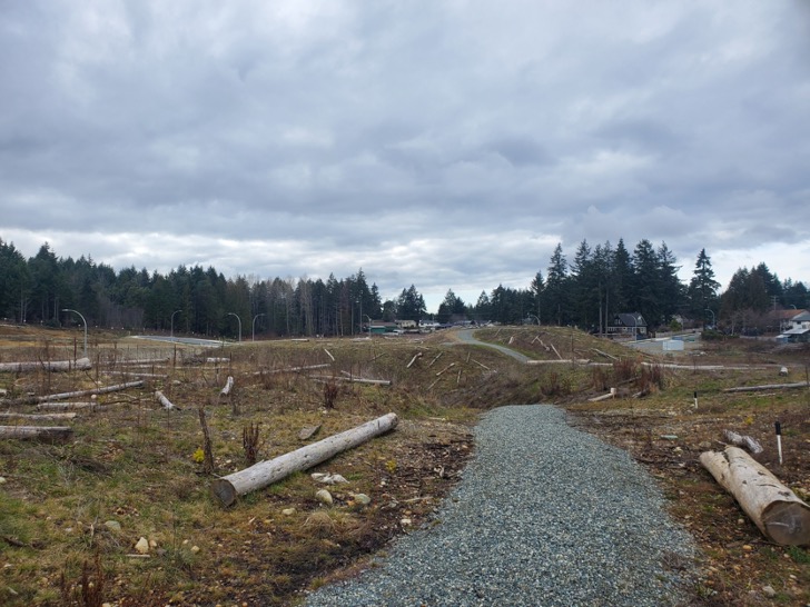
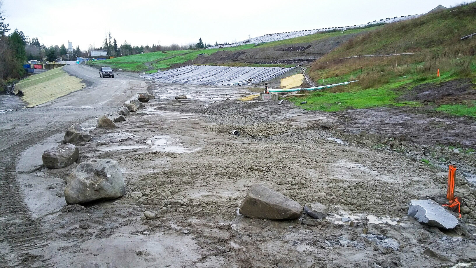
At the landfill, the first processing step is separation of the waste to appropriate landfill cells, and wood crushing. Machinery removes metal from the waste piles and metals such as steel is sent to private companies for further processing. Garbages going into the landfill cells are covered up by steel plates and dirts, and legally the slopes of the garbage piles needs to stay at a slope of 3 to 1 with 58 m of maximum elevation above sea level. Once the waste cells have been crushed to an acceptable slope and covered up, plastic black tarps are installed on them.

The Nanaimo Landfill is affected by a temperate climate with rainy winter, with large quantity of mud interacting with the waste cells and greater production of methane (CH4) in comparison to drier climates. Below the landfill there are abandoned coal mines, and some are filled with decades old waste materials. The most negative wildlife interaction with the wastes are seagulls, to counter this problem bear bangers, cracking noises and prey birds are used.

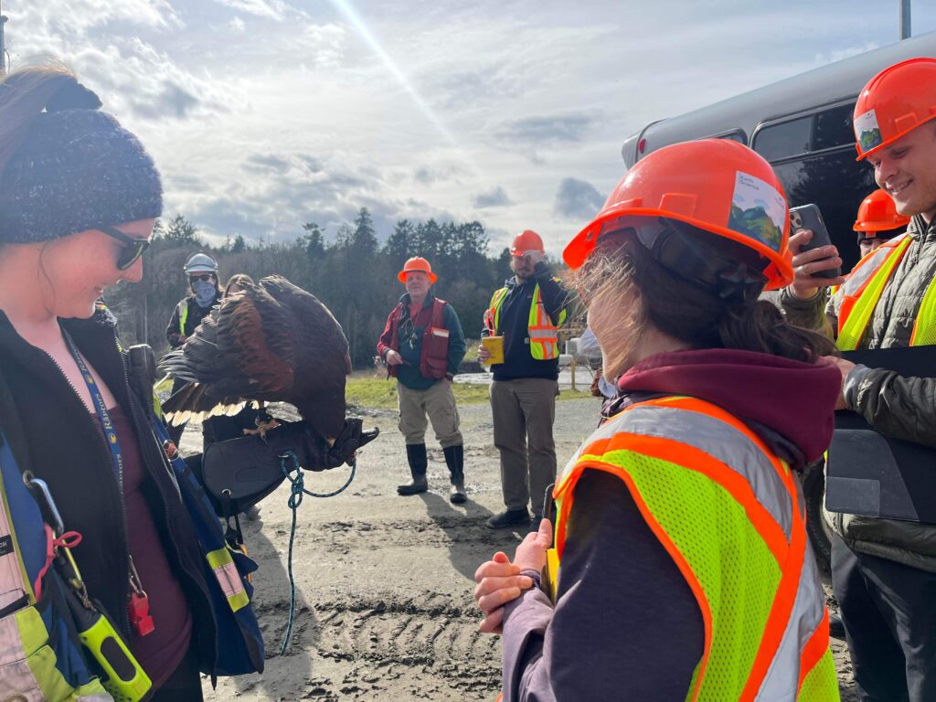
Figure 1. A brave student getting close to an hawk.

The waste produces 40% of CO2 and 60% of CH4, and CH4 flaring takes place at the landfill to reduce greenhouse gases emission. Methane (CH4) is 86 times more potent in comparison to CO2, and flaring reduce its potency into the atmosphere, by burning it to produce CO2 instead. Fortis is interested into using those gases to produce power energy but at this time those are not used to generate power. To collect the gases, vertical and horizontal wells are installed into the waste cells. Wells are filled with clay to create a buffer and avoid interaction with O2, and some of those have a pump to draw the leachates out of the wells to reduce soils and water contamination.

Figure 2. Students listening eagerly during the bus tour of the landfill.

Conclusion and Recommendations

To increase the space capacity of the landfill, trial shredding and compacting of waste materials is currently being done, so far a reduction in volume of 10% to 20% is observed. Garbage shredders are expensive (millions of dollars) which is to be taken into consideration if choosing to incorporate this technique to process wastes, on a long term basis. The population served by the Nanaimo Landfill is likely to increase, and the public must be better educated about the recycling of plastic and microfibre to further reduce the quantity of wastes, for the region.

References

Regional District of Nanaimo. (2024). Regional solid waste management plan (SWMP). Retrieved from https://www.nanaimo.ca/city-services/garbage-recycling/zero-waste-initiatives/regional-solid-waste-management

Phase I – Environmental Assessment Report at 2229 Boxwood Rd, in Nanaimo (B.C.)

Fourth Field Trip

March 6th, 2024

Introduction

On March 6th 2024, students from the Environmental Geology class at Vancouver Island University visited a parcel of land at 2229 Boxwood Road, in Nanaimo (B.C), with the goal of collecting observations to complete a Phase I environmental assessment report . During the fieldwork portion of the project, the daily temperature was 4 ℃ and cloudy . The group was supervised by Professor Tim Stokes and environmental scientist Roxanne Croxall (employed by Tetra Tech Canada Inc.) to learn more about restoration activities undertaken at the location. Two days before this field trip, on March 4th 2024, Roxanne Croxall gave a short presentation about the purpose of environmental assessment report to the Environmental Geology class. On that day, the class was split in groups and each of those completed part of a Phase I Environmental Assessment template for the 2229 Boxwood Road location by doing online research and interviewing Roxanne.

This project is an introduction to Phase I Environmental Site Assessments (ESAs) which is a relatively standard environmental practice in BC when examining sites that may or may not have contamination issues and/or have been identified for development. Those reports are a starting point for any contaminated site investigation which is a historical data gathering process and includes a brief reconnaissance field visit. Usually those reports determine the next stages to plan remediation future activities.

Background

The regional topography where the property is located, slopes gently downward to the northwest. Precipitation obtained from Environment Canada for the period 1981 through 2010, using Nanaimo City Yard station, recorded averages annual rainfall of 1099.6 mm, annual snowfall of 40.7 cm, and annual precipitation of 1140.4 mm. The soil geology of the property area consists of sand fill, gravelly, with some mine waste inclusions. The detailed well records obtained described the soils in the area of the property to contain greater than 20% cobbles, 25 cm of stones at the surface, and coarse fragments content ( 20 to 50%). The soil is capped by less than 50 cm of loamy textured material, imperfectly drained, has weakly cemented horizons and is limited by low nutrients content and low water-holding capacity.

The property does not have an aquifer directly below its surface, and also has no surface water bodies. However, aquifers 167 and 211 can be located to the southwest of the property. Aquifer 167 is a confined sand and gravel unit of glacial origin, most likely set in Quadra Sand. It has low vulnerability, and its well density has moderate productivity rates. Aquifer 167 overlies aquifer 211 which is set within fractured Triassic basalts. Should there be contamination at the property, aquifer 211 is at higher risk than aquifer 167 based on its limited catchment zone, low productivity, and higher well density. The possibility of the property to contaminate aquifer 211 should be taken seriously, as this aquifer contains 388 wells.

Local groundwater flow is inferred to flow to the East following local topography towards East. Subsurface structures, such as catch basins, drainage systems, and underground service trenches in the area may influence the local groundwater flow direction. Activities on sites located upstream of the property have the potential to contaminate the sediments of water bodies that cross through or are adjacent to it. Additionally, contaminants may be transported to the water bodies by overland surface flow and groundwater infiltration. If contaminants enter the system, it could negatively impact the soil and its vapour, the groundwater, and/or its sediments. The nearest surface water body is approximately 337m southeast of the property.

Notes and Observations

At the property construction debris overlies mine waste which is mainly coal waste. Mine waste is the discarded rock overburden during previous coal mining operations and at the site the mine waste volume is 32 000 m3. Soil samples locations were selected using cottonwood as an indicator for soil disturbances. The soil samples were collected from coal waste, and the site tested for heavy metals. The main concern from the results of those samples are high levels of heavy metals such as chromium and arsenic, with the red pink shale having the greatest concentration of arsenic. Additionally, iron, manganese and lithium were found in groundwater (at high concentrations all of those can have negative health impact on humans).

A performance verification recommend a cap of 1 meter of uncontaminated soil on the hills of the site. The forest on the property needs a permit to cut more trees, groundwater wells cannot be installed, restrictions on garden is recommended and residential drinking water is safe where the site is excavated. A shaft capped with concrete and a grid from previous coal mining is located on the property. Dry cleaning products were previously dumped on the property, the site is a former coal mine site, and along with coal mining wastes the site has construction wastes such as pipes. The location of the old lake and two mine portals have a high likelihood of containing mine and construction wastes.

Figure 1. Mine waste at the property.

Conclusion and Recommendations

Further testing for leaching and chemicals contaminants of the coal waste is recommended to determine the next stage of remediation of the property. This will need to be remediated by digging out and removing the stockpiles of coal. Any large construction debris will need to be removed and disposed at regulated facilities.  Any areas that cannot be cleaned up will have strict regulations for usage so that the contamination does not impact residential areas. Chemicals that are of major concern are high levels of arsenic, chromium, lead, mercury, benzene, and cadmium. Contaminated soil will need to be removed from future development sites and the area will need to be capped with 1 m of uncontaminated soil. Soils with light potential for contamination must never be used to access drinking water or growing vegetables. Consistent monitoring of water and soil must be conducted to reduce leaching from the waste.

Stream Restoration at Departure Bay Creek


Third Field Trip

February 28th, 2024

Introduction

On February 28th 2024, students from the Environmental Geology class at Vancouver Island University, examined the Departure Bay Creek in Nanaimo. During the fieldwork portion of the project, the daily temperature was 9 ℃ with rainy weather. The group was supervised by Professor Tim Stokes and met with members of the British Columbia Conservation Foundation to learn more about restoration activities undertaken at the Creek. The BCCF is a charitable not-for-profit society developed with the goal of managing and administrating conservation projects in partnership with various funders. Additionally, the BCCF is supporting the efforts of local conservation organizations in their efforts to enhance and conserve fish and wildlife populations. The students collected information from the speakers and collected observations in their field notebooks, to try to answer the following questions:

  • What the stream and area were like 1000 years, 200 years, 100 years and 50 years ago? 
  • What disturbances have happened to the stream over time? 
  • What type of techniques are being used to restore the stream and its habitat? 
  • Why is this being done? 
  • How can environmental geoscientists contribute to this project?

Background

Departure Bay began to be developed in the late 1800’s with construction of a coal railway/pier system to deliver coal from the Wellington mines to the ships in Departure Bay. The existing development construction started in 1958 with Centennial Park and ended in 1969 with the parking lot and seawall construction along the foreshore. Previous urban stream surveys were funded by the Habitat Conservation Fund in 1993 (Toth) and updated in 2000 through Project 2000 (ATC). Stream restoration work on Departure Creek was done in 1995 and 1996 by Trout Unlimited, Malaspina University College, and local groups. In 2000 the Nanaimo Area Land Trust conducted riparian planting and the Departure Bay Neighbourhood Association completed instream restoration work in 2008. The Harbour City River Stewards continued this work into 2014. Vancouver Island University has conducted water quality analysis in the watershed periodically since 2006. The Community Watershed Monitoring Network has conducted water quality analysis since 2012 (D.R. Clough Consulting, 2016).

The Departure Creek is a small (3.2km2) second order tributary located entirely within the City of Nanaimo. It is approximately 3 km long originating from the Nanaimo Golf Club area
before reaching Departure Bay. The watershed’s main channel flows west to east which is fed by two main tributaries that flow from the north and south. Currently the tributaries (Joseph and Keighly Creeks) offer extremely limited fish access/habitat due to barrier culverts at their confluences (D.R. Clough Consulting, 2016).

The watershed is located in the Coastal Douglas Fir moist maritime (CDFmm) Biogeoclimatic zone (MWLAP 1998) at a median elevation of 70m, in the rain-shadow of Vancouver Island. This climate allows for a diverse group of plants and animals found nowhere else in the country (Madrone 2008). The Creek watershed being severely developed with only the mid reach remaining in a relatively natural state with a functional 2nd growth riparian zone which is greater than 10m wide. The lowest 400m has
been channelized and features a storm water flood diversion. The creek enters the ocean on the north corner of Departure Bay featuring a 2.0 km long gravel and sand beach (D.R. Clough Consulting, 2016).

The North of Departure Bay Creek’s watershed is composed by the Karmutsen Formation (massive and pillowed basaltic flows, breccia), with the Haslam Formation (siltstone with interbedded sandstone, silty shale) to the northwest. The south side of the Creek is composed by the Haslam Formation, the East Wellington Formation ( sandstone, minor gritstone and siltstone), and the Northfield Member (siltstone, carbonaceous shale and coal, lenses of conglomerates and sandstone).

Notes and Observations

The goal of the restoration effort is to return the chum salmons and the coastal cutthroat trouts to the stream. Problems encountered at the Creek that affect fish survival: warm water > 20°C (can cause death), too much sedimentation (fish eggs cannot survive), pollution, and the presence of GPPQE (toxic rubber materials typically from tires on the road) becoming GPPOQ (from friction and UV it becomes toxic) in the stream water. Change of land uses overtime can also changes the water flows between faults, basalt and non-sedimentary beds, reducing the soil cover and ground absorption of water (increasing the velocity of water infiltration to runoff in the Creek and increasing bank erosion), and a greater discharge from the Creek to the ocean means that there is less water available in the Creek during drought (lower water table). The Creek is surrounded by invasive plants species such as the English Ivy, and the black squirrels are eating the bark of trees.

Manmade structures to redirect water flows were built such as the installation of a riprap (permanent layer of large stones to armor, stabilize, and protect the soil surface against erosion and scour in areas of concentrated flow or wave energy) in the Departure Bay Creek. Death trees were added to the Creek to create habitats for the fishes (creating shelter and shade).

Conclusion and Recommendations

The stream water level is lower than it used to be, this decrease in discharge means that the fishes cannot always reach the Creek because it can be dry during drought. The main causes of this disturbance is urban development in the area (change to land uses), which increased the rate of erosion of its banks and reduced its soil cover. From those changes, when heavy rainfall events occur, it creates torrential water in the Creek where the fishes are knocked down into the ocean which reduce their capacity to survive (less refuge). The Creek had a riprap installed, with trees added to the stream to create shelter for the fishes. Additionally, a vegetated riparian buffer was re-established with 100 native trees including Red Alder, Douglas Fir, Giant Sequoia and Big Leaf Maple, as well as a wide range of native shrubs and plants. An instream pool and riffle habitat has also been created along with large woody debris. This provides cover for fish and helps to maintain the streambed (City of Nanaimo, 2024). Future anticipated problems in the Creek could be brought on by climate change which could potentially increases the temperature of the Creek’s water (changing its pH and increasing water acidity) further reducing their chances of survival.

References

City of Nanaimo. (2024). Green initiatives; re: established. Retrieved from https://www.nanaimo.ca/green-initiatives/natural-environment-and-ecosystems/ecosystems/re-established

D.R. Clough Consulting. (2016). Departure Creek habitat assessment report. Retrieved from https://www.rdn.bc.ca/sites/default/files/inline-files/Departure%20Creek%20Habitat%20Assessement%202016.pdf

Sealand Park Slope Stability Mapping

Second Field Trip

February 7th, 2024

Introduction

Under the supervision of Professor Tim Stokes, on February 7th 2024, students from the Environmental Geology class at Vancouver Island University examined slope stability issues at Sealand Park in North Nanaimo. During the fieldwork portion of the project, the daily temperature was 8 ℃ with a partly sunny sky. Groups of two to three students were formed with the goal to document relevant observations at sites of past or active landslides. Each group collected their own observations and developed a preliminary slope stability hazard map of the Sealand Gully and part of the shoreline. Features were located on topographic and LiDAR maps, placemark were saved in Avenza Maps (using a geo-referenced map) at each site of interest within the gully, soil samples were collected, and all observations documented into a field notebook. Once the fieldwork was completed the team developed a simple hazard map of Sealand Gully and part of its shoreline. Additionally, a simple risk analysis of the site accounting for potential impact to structures and properties was completed. The purpose of this field trip was to examine the possible causes of the landslides at Sealand Park, to identify sites with higher risk of future failures and better understand their impacts to infrastructures. 

Background

Vancouver Island has an extensive glacial history with records of glaciation dating back to 194,000 years ago during the Penultimate. The latest glaciation is that of the Wisconsinian that occurred approximately 75,000 years ago. The Wisconsin Glaciation deposited a variety of sedimentary deposits including but not limited to glacial, glaciofluvial, lacustrine, and marine. These are defined lithostratigraphic deposits based on the means and climatic conditions in which they were deposited. 

 Sealand Park possessed thick deposits (tens of meter) consisting of Cowichan Head, Quadra Sand, Vashon drift and Capilano Sediments, and is situated within an existing gully that no longer possess an active stream channel and has been altered to such an extent that it is no longer viable for fish habitation. At the base of the gully an artificial pathway was constructed. The gully is exclusively cut through glacial material from the past flow path of the stream with the banks often presenting severe angles of repose. This degree is common given the composition of the deposits. Bedrock is not observable at the surface. The north-west extent of the park transitions into a high energy intertidal zone based on the large sized and well-rounded cobbles and boulders. 

Notes and Observations

Table 1. Field Observations at Each Site at Sealand Park Gully.

Site #DimensionsSlopeSlope GeometryVolume of Debris PileComments
1Displaced Materials: ≈30 m length ✕ ≈4 m width ✕ ≈2 m thickSlope Length: ≈30 mHead Scarp Height: ≈20 m42°Concave≈ 240㎥Shallow translation/ Earth fall/ Sparsely vegetated by ferns/J-hooked treesVashon drift underlain by Quadra sands.
2Displaced Materials: ≈20 m length ✕ ≈10 m width ✕ ≈5 m thickSlope Length: ≈20 mHead Scarp Height: ≈50 m42°Concave≈ 1000㎥Aged slump/  Middle-aged forest/ Slope sparsely vegetated with ferns/ J-hooked trees/ Overhang & head scarp with fresh fall to left/ Irregular slump.
3Displaced Materials: ≈30 m length ✕ ≈60 m width ✕ ≈5 m thickSlope Length: ≈ 30 mHead Scarp Height: ≈38 m32°Concave≈ 9000㎥Middle-aged forest with dense floor cover/ Irregular slope/ Unidentifiable failure mechanism due to vegetation/ Debris pile sparsely vegetated with ferns/ Head scarp inwards.
4Displaced Materials: ≈ 30 m length ✕ ≈ 60 m width ✕ ≈  5 m thickSlope Length: ≈ 30 mHead Scarp Height: ≈ 17 m31°Concave≈  9000㎥Earth fall/ Creep/ Possibly shallow translational/ Sparsely vegetated with ferns & middle-aged trees / Initial runout flat and regular that follows into irregular runout/ Middle-aged forest/ 40 horizontal  / J-hooked trees at different directions/  Vertical head wall made of clay rich Vashon Drift(?)
5Displaced Materials: ≈ 30 m length ✕ ≈ 20 m width ✕ ≈ 5 m thickSlope Length: ≈ 30 mHead Scarp Height: ≈ 40 m43°Concave≈ 3000㎥Middle-aged forest with  mature tree growth & sparsely vegetated ferns/ J-hooked trees/ Creep/ Irregular slope / Earth fall?/ Debris pile has regrowth on top/ Narrower comparatively
6Displaced Materials: ≈ 15 m length ✕ ≈ 20 m width ✕ ≈ 5 m thickSlope Length: ≈ 15 mHead Scarp Height: ≈ 100 m28°Concave≈ 1500㎥Vashon drift/ J-hooked trees/  Earth flow? Creep?/ Head wall with gradient Curved head scarp/ Fresh runout over vegetation / House up above on head wall/ Middle-aged forest & sparsely vegetated with ferns/ Regrowth on debris pile
7Displaced Materials: ≈ 30 m length ✕ ≈ 3 m  width ✕ ≈ 3 m thickSlope Length: ≈ 30 mHead Scarp Height: ≈ 10 m28°Concave≈ 270㎥Overhanging head scarp (vertical) of Vashon drift (lenses and till)/ Runout irregular with recent colluvium and dead vegetation/ J-hooked trees/ Silt layer/ Regrowth on debris pile (middle-aged forest)/ Earthfall?Vashon Drift (lenses and till), silt layer within till
8Displaced Materials: ≈ 15 m length ✕ ≈ 30 m width ✕ ≈ 3 m thickSlope Length: ≈ 15 mHead Scarp Height: ≈ 20 m40°Concave≈ 1350㎥Earth flow /Debris flow fall with active creep and water flow on clay rich till(?)/  No observable head scarp/  Linear flow/ No translation/ Slight bowl shape/ Debris pile with regrowth (middle-aged forest)/ Sparsely vegetated with ferns/ J-hooked trees

Table 2: Slope Stability Hazard Rating.

Slope Stability Hazard RatingHazard Rating Probability/LikelihoodDescriptions of Slope Conditions
HighProbability of slope failure is eminent, and the magnitude could be considerableEvidence of natural landslide occurrence with a slope angle equal to or greater than 30 degrees. Urban development is within direct runout zone or proximal to head scarp. 
Moderate          The probability of slope failure resulting in considerable mass movement of urban disturbance is not expectedwithin predictable parameters*, however, regular inspection is recommended.Slope angle less than 30 degrees. Urban development is within vicinity. Poor to well-drained soils. Moderate gullying. Increased erosion expected following drainage disturbance. Water courses could cause higher potential of bank slumping. 
Low Probability of slope failure is unlikely, and magnitude is low unless extraneous conditions arise.Slope angle is within 0 to 15 degrees. Poor to well drained soils. Minor slumping following ground disturbance  
 

Sealand Park Slope Stability Hazard Map

Figure 1. Sealand Park Slope Stability Hazard map, built by Fanny Deschenes and Aiden Kilcommons.

Conclusion and Recommendations

 Risk analysis is based on in-situ site analysis, air photo interpretation, satellite imagery (Google Earth) in concordance with the existing knowledge and experience of the semi-qualified terrain specialists.  

Within the area of interest (AOI) recent landslides are present providing an indication for the likelihood and magnitude of a subsequent mass wasting event. Air photos and satellite imagery provide comparison of historic conditions to present day. Knowledge and experience of terrain specialists can capture information from the former qualitative attributes to develop a rational for the terrain hazard rating.  From the risk analysis completed at Sealand park, the following recommendations are proposed:

  • Avoid undercutting steep slopes.
  • No building near those slopes (base and top).
  • Do not fill steep slopes.
  • Re-vegetation of the gully banks.
  • Installation of drainage systems.
  • The drainage of large quantity of water should be avoid within the areas (draining pools, etc.)