Reflection About Environmental Geology (GEOL 312)

Final Blog Post

April 12th, 2024

This semester for me was bitter sweet, as I am at the end of my undergraduate degree after four and a half years at Vancouver Island University in the Geoscience Major. The Environmental Geology class was truly beneficial for me as I am planning a career in an environmental field and this class focus on so many aspects to take into accounts when making decisions as a future environmental geoscientist (not just rocks), or as a professional in environmental policies. Through seven field trips, class activities and lectures I felt more confident to undertake a career in this field. The course covered multiple aspects with the following goals:

  • Studying the earth’s surface, oceans, and atmospheres to better understand issues related to interconnectivity between land, water, air, and biota.
  • Identifying, assessing, and mitigating the impacts that geological hazards have on humans.
  • Assessing and managing surface water and groundwater to ensure sufficient supply of clean water.
  • To understand how and when there is contamination of water, and also flooding and droughts.
  • Managing  domestic, industrial, and mining waste in a geological context to consider disposal techniques, minimize contamination and the dispersal of pollutants, along with issues related to recycling. 
  • Investigating fossil fuels (coal, oil, gas, conventional & unconventional) and alternative energy (nuclear, hydro, solar, wind, tidal & run-of-river) in terms of efficiency, power output, costs and environmental impacts including carbon emissions.

A Career in Environmental Policies?

I have spent four and a half year studying science with the personal ambition to help somehow solving environmental problems, but this last year of studying really opened my eyes on the importance of policies to solve those issues. Through the climatology class and the environmental geology class I realized that environmental problems are very strongly linked to social dynamics and politics, and I am now considering pursuing a master in environmental policies in the United Kingdom, or teaching. In many field trips completed in GEOL 312, the geoscientists or experts knew the local issues but the politics and public were slowing down the effort to implement those changes (legally, budget, etc.). For example at the landfill, flaring of methane was an excellent mitigation technique to reduce emissions of greenhouse gases but the product of flaring was wasted, because old business contracts from potential buyers of this product (FortisBC) was slowing down their capacity to do so. Globally, if we are serious about curbing the worst effect of climate changes, many policies must be adapted to help scientists reduce anthropogenic greenhouse gases emissions and negative impacts from anthropogenic activities., not impede them. Additionally, I am a little seduce by the idea of wearing a wig (see Figure 1) in the UK (should I work in policies there).

Figure 1. A symbol of power and respect for the law, in the UK.

The GeoExchange Providing Sustainable Energy at Vancouver Island University

Seventh Field Trip

April 8th, 2024

Introduction

On April 8th, 2024 students from the Environmental Geology class at Vancouver Island University took a tour of the GeoExchange directly on Vancouver Island University Campus (Vancouver Island, Nanaimo, B.C.), under the supervision of Professor Tim Stokes. During the visit, the daily temperature was 8 ℃ and the sky was cloudy. The goal of the field trip was to better understand the geothermal energy system named the GeoExchange at Vancouver Island University. Climate change brought up by anthropogenic emissions of greenhouse gases increases the average global temperature on Earth by 1.1 ℃ since 1880, according to the Goddard Institute for Space Studies (GISTEMP Team, 2024). Switching to clean sources of energy, such as wind and solar, is not only a way to reduce anthropogenic emissions of greenhouse gases, but also a way to reduce air pollution and improve our health. Prior to the visit Professor Stokes gave a short overview of the GeoExchange system to the class. During the visit field notes with observations about characteristics of the GeoExchange were collected. 

Background

Figure 1. Geoexchange energy system map (Vancouver Island University, Nanaimo, B.C).

The first borehole (exploratory borehole) was drilled in 2010 (IW‐2) to a depth of 164 m, and a delivery rate of 31 l/sec was produced. Pump testing of this 2010 borehole noted a change of the water level of an observation level near NDS track, confirming that an open underground flow link existed in the abandoned mine workings. Water samples taken from the well indicated that this water was of poor quality and potentially corrosive (high TDS, high in metals and ions, high in bacterias and highly alkaline).

The Geoexchange energy system at Vancouver Island University is located at the Geo-Exchange Building (HSC1 on the map in Figure 1), and relies on water trapped underground in the abandoned Wakesiah mine, it supplies heat to the University’s buildings in coolest months and air conditioning in warmest months.

The GeoExchange energy system was completed in 2018 and relies on mine water at average year‐round temperature from the abandoned Wakesiah Colliery coal mine. This mine water is below most campus at depths of 134‐190 m and the system uses a mine water loop to extract water from one hole (PW‐1). Then the water is put through a heat exchange system in a pump house, where the cooled water is returned into an injection borehole (IW‐1 or 1W‐2). A second ambient water loop takes warm water from heat exchange system at the pump house and transport it to Health & Science buildings where it is used to heat or cool them, after which it is returned to the pump house.

Energy needs for the Health & Science buildings are 95kWh/m2 for heating and 57kWh/m2
for cooling. The GeoExchange system reduce energy needs for the Health & Science buildings by 75%. For every unit of electrical energy used to run system it produces
approximately four equivalent units of heat. Estimated energy saving of $66,000 per year compared to equivalent use of gas for heating, is produced with the GeoExchange system.

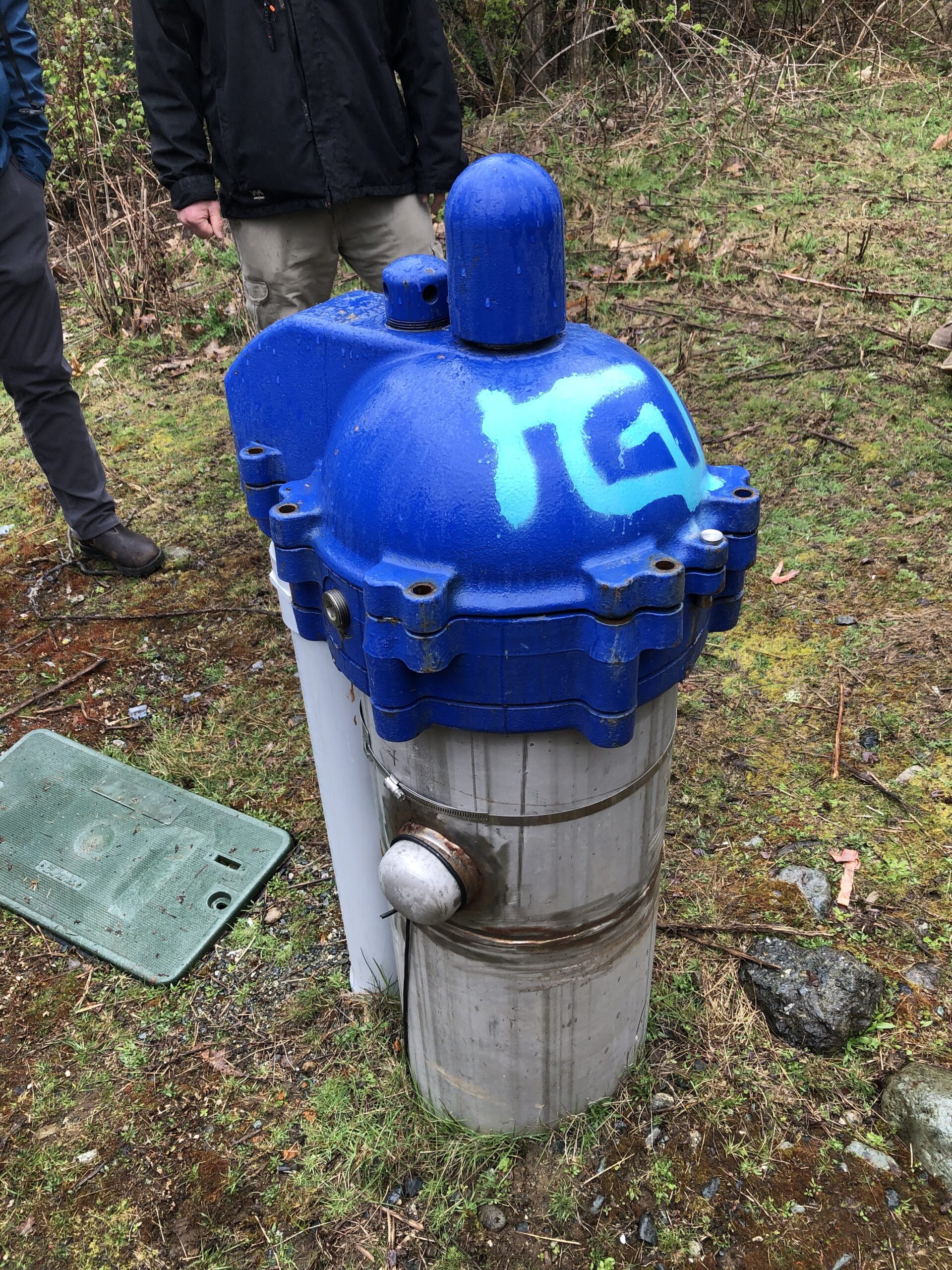
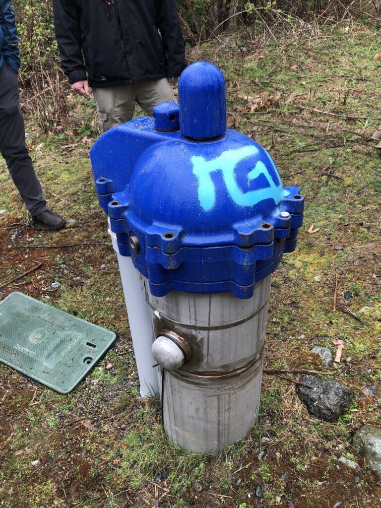
Figure 2. Water well producing the north mine water at Vancouver Island University (Nanaimo, B.C.).

Notes and Observations

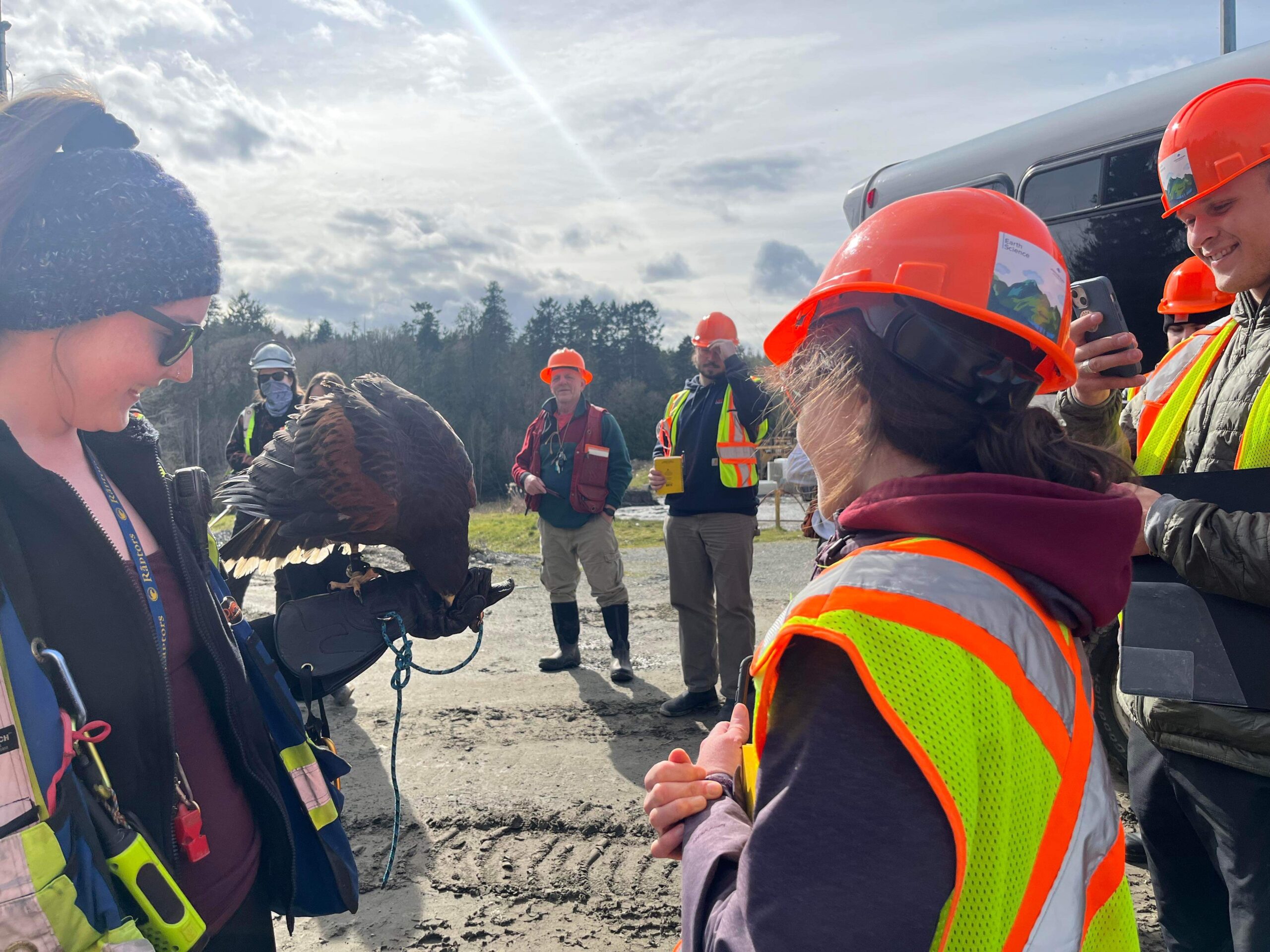
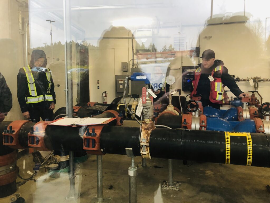
The geo-exchange relies on groundwater trapped in the old Wakesiah coal mine transported all the way from a well located on the north side of the campus (see Figure 2) to the heat exchanger in the Geo-Exchanged building. The system uses its ambient temperature loop to store heat from buildings into cooler groundwater (in the summer), and extracts the heat the warmer groundwater (in the winter) to warm the Health & Science buildings. At full capacity the system can extract water at an average rate of 15L/s and during the tour (on April 8th, 2024), Falcon Engineering engineers were testing the GeoExchange system at full capacity (see Figure 3).

Figure 3. Engineers working hard and testing the GeoExchange system at its full capacity.

Conclusion and Recommendations

The GeoExchange system at Vancouver Island University is dependant on the void spaces left by coal mining underneath the University, and in this regard geoscientists were essential in ensuring the safety and feasibility of such project. Geoscientists helped engineers by providing key geological information about the geological subsurface, allowing for the adequate design and installation of this geothermal system that relies on old mine waters, for both storage and extraction of heat.

References

GISTEMP Team. ( 2024). GISS Surface Temperature Analysis (GISTEMP), version 4: NASA Goddard Institute for Space Studies. Retrieved from https://data.giss.nasa.gov/gistemp/.

Lantzville Shoreline Protection and Building a Green Residential House

Sixth Field Trip

March 27th, 2024

Introduction

On March 27th, 2024 students from the Environmental Geology class at Vancouver Island University visited Huddlestone Beach (Lantzville) as well as Piper’s Lagoon Park (Nanaimo), on Vancouver Island (B.C.), under the supervision of Professor Tim Stokes. During the visit, the daily temperature was 6 ℃ and the sky was cloudy with light rain. The goal of the field trip was to better understand the challenges of living in this region, specifically the issue of shoreline erosion and its protection. Climate change disturbs the global mean sea level by adding volume of water to the oceans in two ways, through the melting of ice sheets and glaciers, and by warming the water temperature leading to its expansion. Prior to the visit an investigation of both sites was completed using Google Earth, the Landowners Guide to Protecting Shoreline Ecosystems and Green Shores for Homes (Credit & Rating System, 2015), Passivhaus (An Introduction, 2012), and Green Building in Canada. During the visit field notes with observations about material types, shoreline protection measures, and Green Building construction characteristics were collected. 

Background

In Nanaimo, climate change brings higher temperatures, wetter winters, and drier summers. In 2022, the City of Nanaimo Council adopted City Plan, which is a plan with a number of policies to help support the City adapt to Climate Change. Climate change adaptation strategies can be found throughout City Plan and included two new Development Permit Areas for Sea Level Rise and Wildfire Mitigation to help guide and protect new development from future climate hazards. A development permit (DP) allows City staff to review proposed developments to ensure they meet the policies and objectives of the Official Community Plan as well as the City’s environmental, heritage, and design guidelines. There are nine Development Permit Areas in the City, which serve various purposes including: the protecting the natural environment, ensuring that development considers hazardous site conditions, and ensuring the form and character of development follows relevant design guidelines (The City of Nanaimo, 2023).

In 2018, the Province of BC adopted an amendment to the Flood Hazard Area Land Use Management Guidelines that incorporated new building standards for coastal areas that consider relative sea level rise (RSLR) to 1.0 metre by 2100. The City’s Sea Level Rise Study (Study) was completed in 2019 and is a high-level vulnerability assessment of the City’s coastline. This Study includes sea level rise projections for 2050 and 2100; an assessment of potential coastal erosion impacts and defines a Flood Construction Level (FCL) along the City’s shoreline for 2050 and 2100. Results from this Study indicated that low-lying areas along the coastline are vulnerable to sea level rise, and specifically Departure Bay, Duke Point, Protection Island, and portions of the Downtown (The City of Nanaimo, 2023).

The restoration of a Property’s riparian area was completed in 2020 for shoreline stabilization and erosion control. The property lies on shoreline adjacent to the City of Nanaimo Piper’s Lagoon Waterfront Park, located in the NE part of Nanaimo. Shack Island lies just offshore of this property and provides shelter from the prevailing winds off the Strait of Georgia. Unique patterns of ocean current and abundant use of the foreshore by waterfowl also characterize this site. The low bank beach is gently sloped with sand and cobble-sized material. The overall site is within an intact Garry Oak ecosystem, and the property includes some Garry Oak trees recognized as Significant Trees under the City of Nanaimo’s Management and Protection of Trees Bylaw 2013 (No. 7126) (preserved during the development). The main objective of the project was to remove the bulkhead and restore the foreshore with natural materials and native vegetation to stabilize against erosion and create shoreline habitat. The restoration project removed a concrete bulkhead with a wooden fence attached to the top and a previously used septic system. The entire riparian area was regraded using existing beach materials and tidal function was fully restored through removal of the bulkhead. Large woody material was retained, and small boulders and new stumps and logs were placed higher on the slope to protect the shore through dissipation of wave energy (The Stewardship Centre for British Columbia, 2021).

Notes and Observations

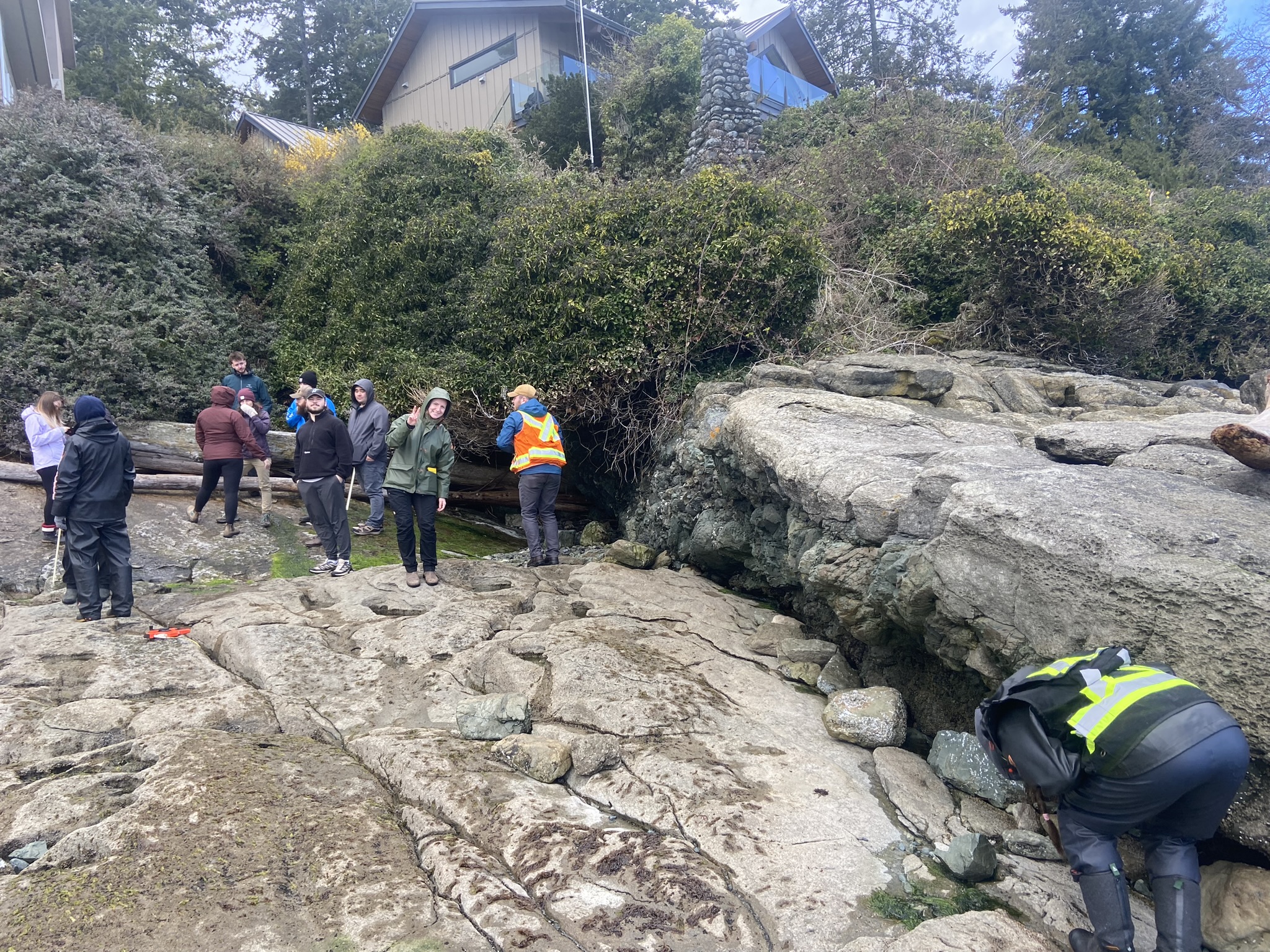
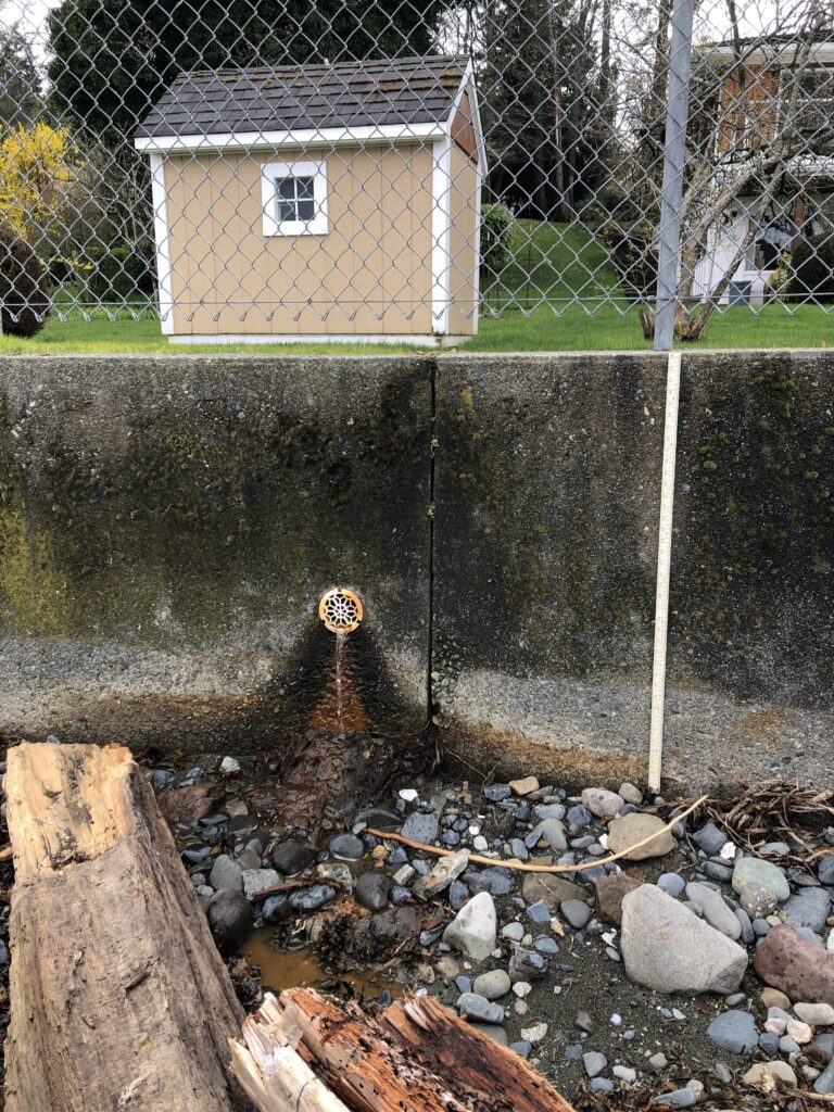
The material type at Huddlestone Beach (Lantzville) is cobbly sand. Evidence of shoreline erosion due to wave energy paired with unconsolidated sediments can be observed. The shoreline shows signs of sediments loss (especially at the base of the scarp) and a beach scarp at height of about 0.80-0.40 m is observed. Signs of erosion are apparent at the base of an old concrete wall, a riprap, and a pile of coal waste materials through materials loss. The old concrete wall is made of concrete embedded with rounded cobbles (height is about 1.2 m) and is eroded at the contact between the level of the tidal waves and the shoreline (erosion height about 0.30 m). A recently installed 0.80 m high and 100 m long concrete wall is installed eastward of the beach. The concrete wall has drainage installed (at 0.50 m in height) and suggests that the high tide line is about 0.25 m. The beach has some cobbly sand with mostly rounded cobbles, some coal and large logs deposited almost parallel to the shoreline. A lot built on coal waste piles has the most severe signs of erosion, and some concrete “pillows” are attached with rods to the shoreline (at 0.10 m in height).

Aspects of Green Building constructions incorporated at the Eby road property are the planting of vegetation on the beach scarp, and the installation of large wood logs on the beach to mitigate erosion and promote ecological resilience. Additionally, hard stabilization methods such as a riprap, concrete walls and concrete “pillows” with rods are used to decrease erosion of the shoreline.

Figure 1. The 100 m concrete bulkhead with drainage systems eastward of Huddlestone Beach.

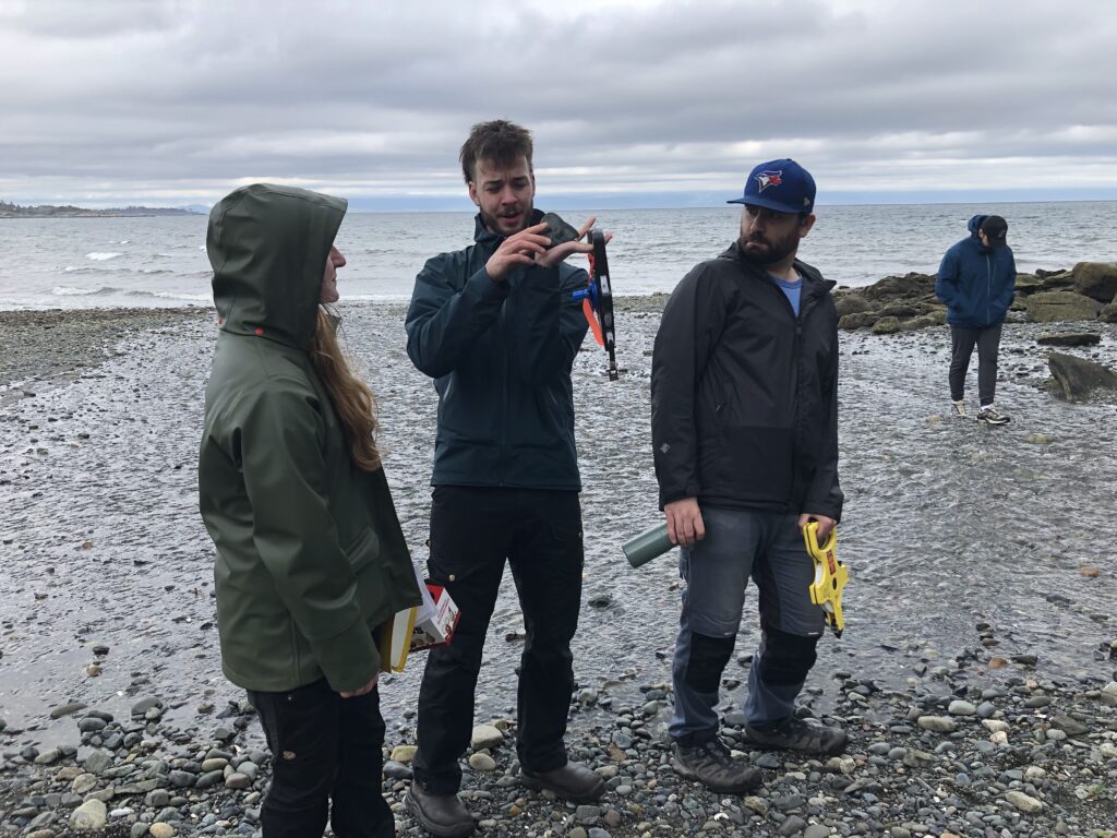
Figure 2. A trio of passionated young students easily impressed by beach sediments.

Conclusion and Recommendations

All things considered, the best method to mitigate shoreline erosion is the restoration of the beach riparian area to its “natural” state paired with a concrete bulkhead at the beach scarp with a drainage system, and logs on the beach. This would increase resilience to storm events, provide habitat to ecosystems, reduce erosion, and moderate wave action. The concrete bulkhead has a long lifespan and requires simple repair, and the restoration lower environmental impact at the shoreline.  Depending on the future rate of sea level rise, building a seawall to prevent the impact of storm surge flooding and floods might be necessary but its trading off the intertidal zone for infrastructures safety.

References

The City of Nanaimo. (2023). Green Initiatives. Retrieved from https://www.nanaimo.ca/green-initiatives/climate-adaptation

The City of Nanaimo. (2023). Property and Development. Retrieved from https://www.nanaimo.ca/property-development/development-applications/development-permits

The Stewardship Centre for British Columbia (SCBC). (2021). Green Shores Case Studies (Piper’s Lagoon, City of Nanaimo, British Columbia). Retrieved from https://stewardshipcentrebc.ca/pipers-lagoon-city-of-nanaimo/