Third Field Trip
February 28th, 2024
Introduction
On February 28th 2024, students from the Environmental Geology class at Vancouver Island University, examined the Departure Bay Creek in Nanaimo. During the fieldwork portion of the project, the daily temperature was 9 ℃ with rainy weather. The group was supervised by Professor Tim Stokes and met with members of the British Columbia Conservation Foundation to learn more about restoration activities undertaken at the Creek. The BCCF is a charitable not-for-profit society developed with the goal of managing and administrating conservation projects in partnership with various funders. Additionally, the BCCF is supporting the efforts of local conservation organizations in their efforts to enhance and conserve fish and wildlife populations. The students collected information from the speakers and collected observations in their field notebooks, to try to answer the following questions:
- What the stream and area were like 1000 years, 200 years, 100 years and 50 years ago?
- What disturbances have happened to the stream over time?
- What type of techniques are being used to restore the stream and its habitat?
- Why is this being done?
- How can environmental geoscientists contribute to this project?
Background
Departure Bay began to be developed in the late 1800’s with construction of a coal railway/pier system to deliver coal from the Wellington mines to the ships in Departure Bay. The existing development construction started in 1958 with Centennial Park and ended in 1969 with the parking lot and seawall construction along the foreshore. Previous urban stream surveys were funded by the Habitat Conservation Fund in 1993 (Toth) and updated in 2000 through Project 2000 (ATC). Stream restoration work on Departure Creek was done in 1995 and 1996 by Trout Unlimited, Malaspina University College, and local groups. In 2000 the Nanaimo Area Land Trust conducted riparian planting and the Departure Bay Neighbourhood Association completed instream restoration work in 2008. The Harbour City River Stewards continued this work into 2014. Vancouver Island University has conducted water quality analysis in the watershed periodically since 2006. The Community Watershed Monitoring Network has conducted water quality analysis since 2012 (D.R. Clough Consulting, 2016).
The Departure Creek is a small (3.2km2) second order tributary located entirely within the City of Nanaimo. It is approximately 3 km long originating from the Nanaimo Golf Club area
before reaching Departure Bay. The watershed’s main channel flows west to east which is fed by two main tributaries that flow from the north and south. Currently the tributaries (Joseph and Keighly Creeks) offer extremely limited fish access/habitat due to barrier culverts at their confluences (D.R. Clough Consulting, 2016).
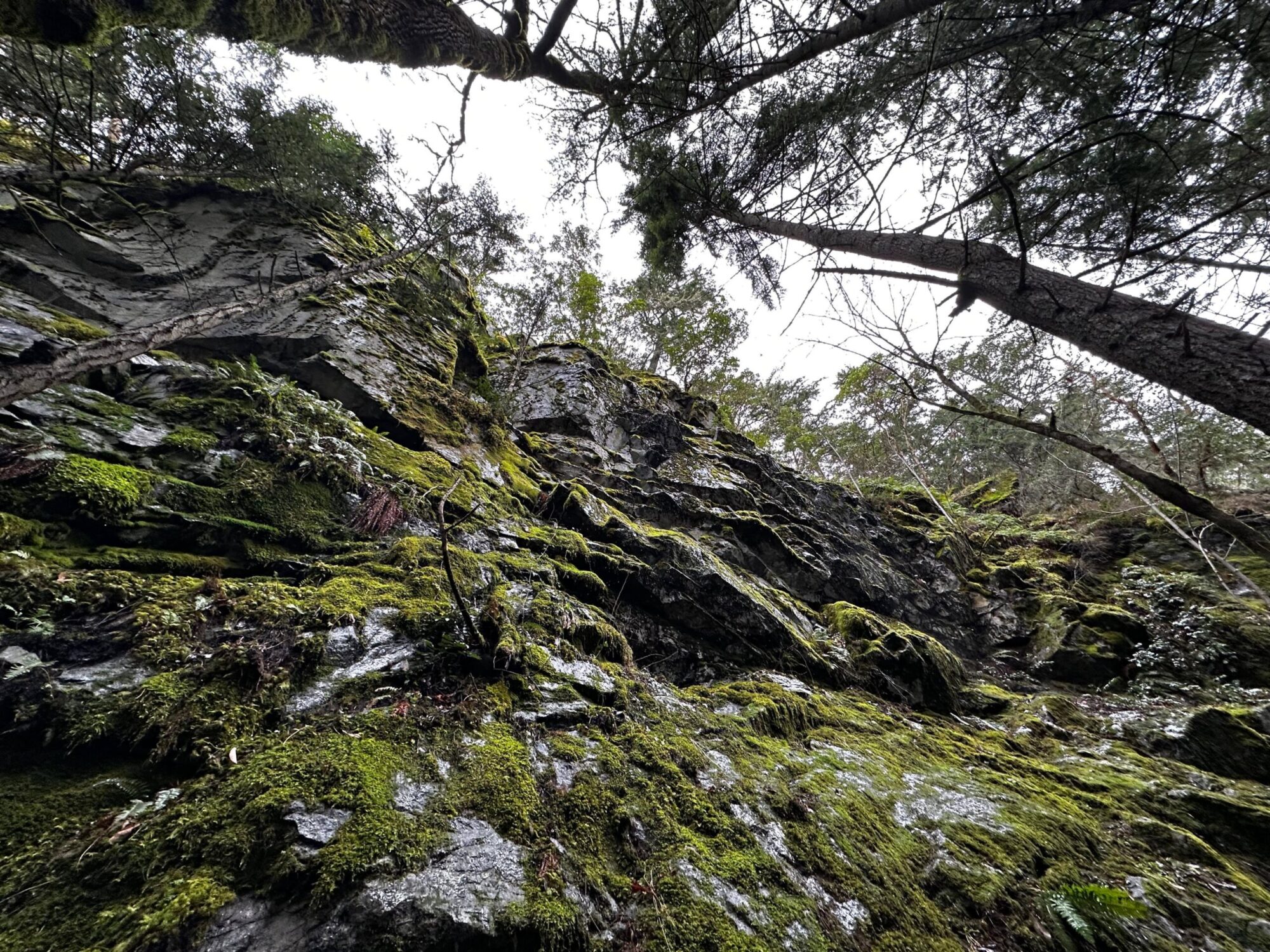
The watershed is located in the Coastal Douglas Fir moist maritime (CDFmm) Biogeoclimatic zone (MWLAP 1998) at a median elevation of 70m, in the rain-shadow of Vancouver Island. This climate allows for a diverse group of plants and animals found nowhere else in the country (Madrone 2008). The Creek watershed being severely developed with only the mid reach remaining in a relatively natural state with a functional 2nd growth riparian zone which is greater than 10m wide. The lowest 400m has
been channelized and features a storm water flood diversion. The creek enters the ocean on the north corner of Departure Bay featuring a 2.0 km long gravel and sand beach (D.R. Clough Consulting, 2016).
The North of Departure Bay Creek’s watershed is composed by the Karmutsen Formation (massive and pillowed basaltic flows, breccia), with the Haslam Formation (siltstone with interbedded sandstone, silty shale) to the northwest. The south side of the Creek is composed by the Haslam Formation, the East Wellington Formation ( sandstone, minor gritstone and siltstone), and the Northfield Member (siltstone, carbonaceous shale and coal, lenses of conglomerates and sandstone).
Notes and Observations
The goal of the restoration effort is to return the chum salmons and the coastal cutthroat trouts to the stream. Problems encountered at the Creek that affect fish survival: warm water > 20°C (can cause death), too much sedimentation (fish eggs cannot survive), pollution, and the presence of GPPQE (toxic rubber materials typically from tires on the road) becoming GPPOQ (from friction and UV it becomes toxic) in the stream water. Change of land uses overtime can also changes the water flows between faults, basalt and non-sedimentary beds, reducing the soil cover and ground absorption of water (increasing the velocity of water infiltration to runoff in the Creek and increasing bank erosion), and a greater discharge from the Creek to the ocean means that there is less water available in the Creek during drought (lower water table). The Creek is surrounded by invasive plants species such as the English Ivy, and the black squirrels are eating the bark of trees.
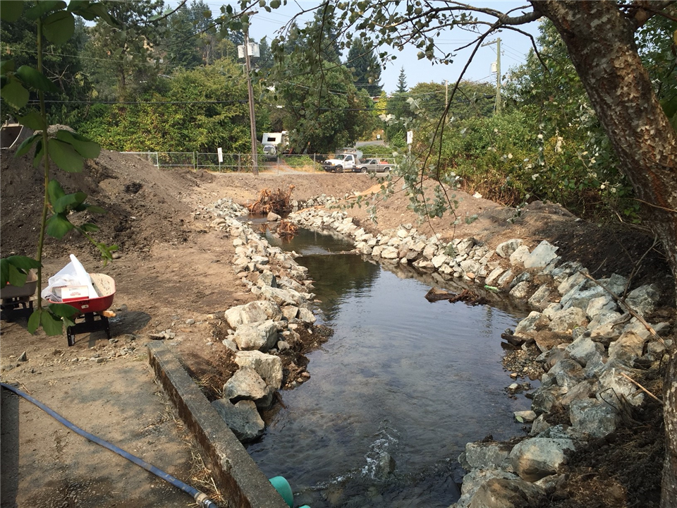
Manmade structures to redirect water flows were built such as the installation of a riprap (permanent layer of large stones to armor, stabilize, and protect the soil surface against erosion and scour in areas of concentrated flow or wave energy) in the Departure Bay Creek. Death trees were added to the Creek to create habitats for the fishes (creating shelter and shade).
Conclusion and Recommendations
The stream water level is lower than it used to be, this decrease in discharge means that the fishes cannot always reach the Creek because it can be dry during drought. The main causes of this disturbance is urban development in the area (change to land uses), which increased the rate of erosion of its banks and reduced its soil cover. From those changes, when heavy rainfall events occur, it creates torrential water in the Creek where the fishes are knocked down into the ocean which reduce their capacity to survive (less refuge). The Creek had a riprap installed, with trees added to the stream to create shelter for the fishes. Additionally, a vegetated riparian buffer was re-established with 100 native trees including Red Alder, Douglas Fir, Giant Sequoia and Big Leaf Maple, as well as a wide range of native shrubs and plants. An instream pool and riffle habitat has also been created along with large woody debris. This provides cover for fish and helps to maintain the streambed (City of Nanaimo, 2024). Future anticipated problems in the Creek could be brought on by climate change which could potentially increases the temperature of the Creek’s water (changing its pH and increasing water acidity) further reducing their chances of survival.
References
City of Nanaimo. (2024). Green initiatives; re: established. Retrieved from https://www.nanaimo.ca/green-initiatives/natural-environment-and-ecosystems/ecosystems/re-established
D.R. Clough Consulting. (2016). Departure Creek habitat assessment report. Retrieved from https://www.rdn.bc.ca/sites/default/files/inline-files/Departure%20Creek%20Habitat%20Assessement%202016.pdf