Day 10 Return to Reyjavik

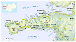
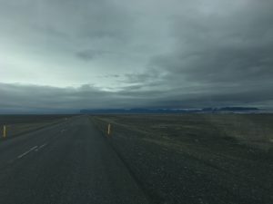
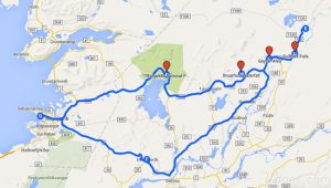
The last day of the GEOL 390 field trip to Iceland was to be a long day’s drive back from Akureyri in the north to Reykjavik in the south, a total of 385 km.  This was to be through some of the ‘less geologically exciting’ parts of Iceland, but as usual we had some surprises.

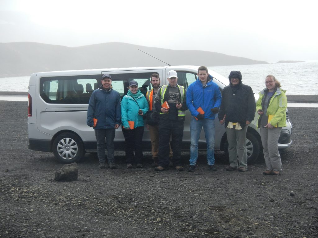
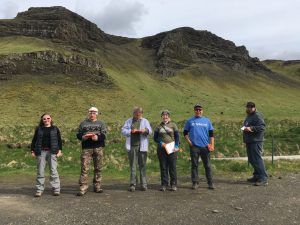
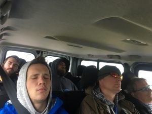
The day started well with sun at last and a cool 6-7 C.  The bus was loaded and ready for a later departure than usual at 10 am.  Fours stops were planned along the route based on our reconnaissance of the road during Day 8.

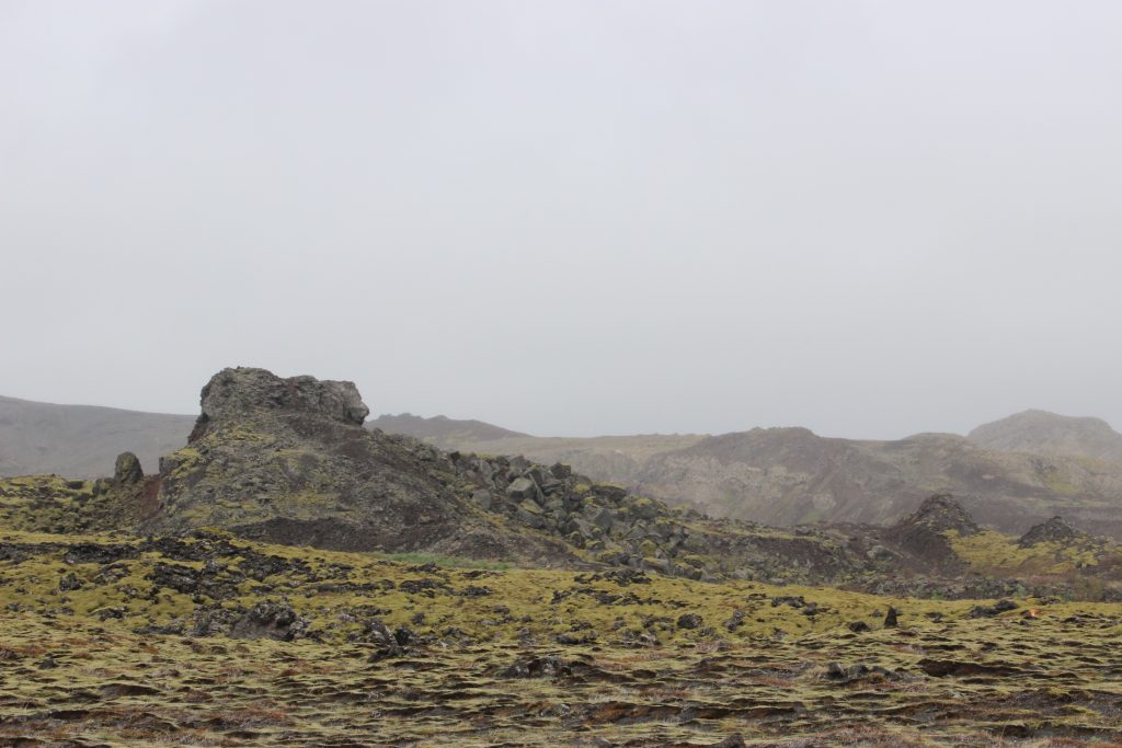
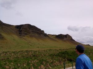
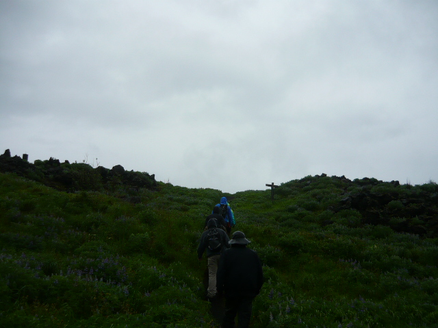
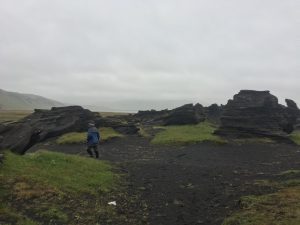
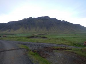
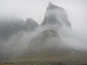
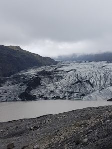
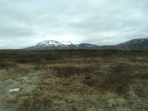
The first stop was to examine some jagged mountain peaks from the road, that were distinctly different from the table top plateaus of the Tertiary basalts – likely scrapped flat during a number of previous glacial.   These jagged peaks corresponded to some rhyolite extrusives on the geology map.  However, with the fog low on the mountains and the driver focused on the road the site was completely missed!  Something for next time.

The level ‘table top’ mountains formed by glacial erosion of Tertiary basalts

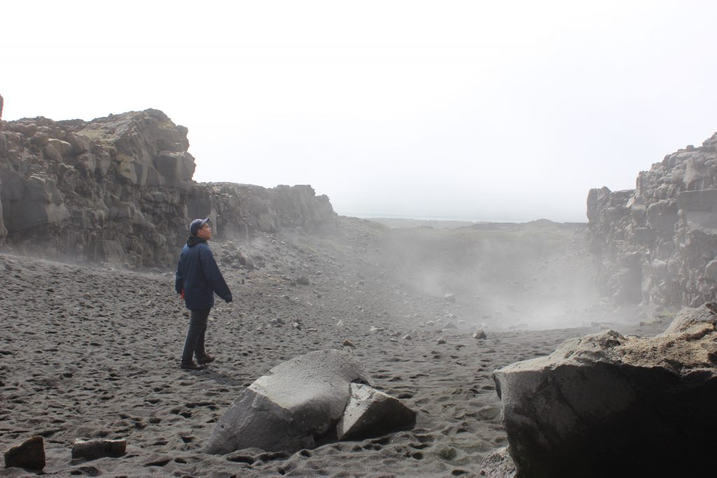
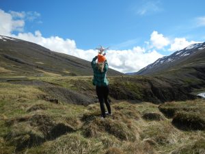
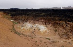
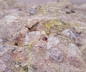
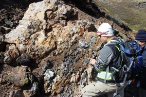
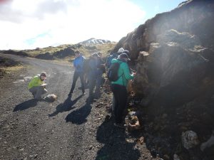
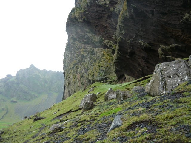
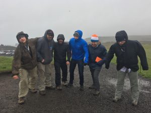
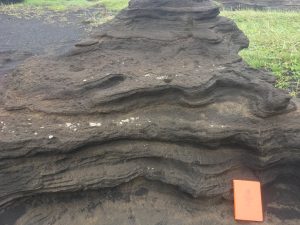
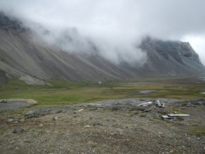
The second stop was to examine a sedimentary lignite layer (a precursor to coal) that is clearly shown on the Iceland geology maps as black lines within the Tertiary basalts.  This layers marks a geological unconformity and a period of  a warmer climate and vegetation growth.  The most likely looking site was a steeper river canyon where we had spotted some red layering previously.  We found a good road pullout for a 10 minute stop, which as usual turned into 45 minutes!  While the students went off to check out some of the red layering, Tim chatted with some tourists (a drone operator and his wife) to see if they would photograph the layers for us on the other side of the canyon.  They did so and promised to send photos later.  From some samples that were collected it was deduced that the red laying was a red sandstone marking a distinct period of sediment deposition between volcanic events.  No sign of lignite.  (A later discussion with a local geologist indicated that this layer was typically very difficult to locate, as it easily erodes away.)

Examine the red layers within the Tertiary basalts


Capturing the drone

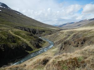
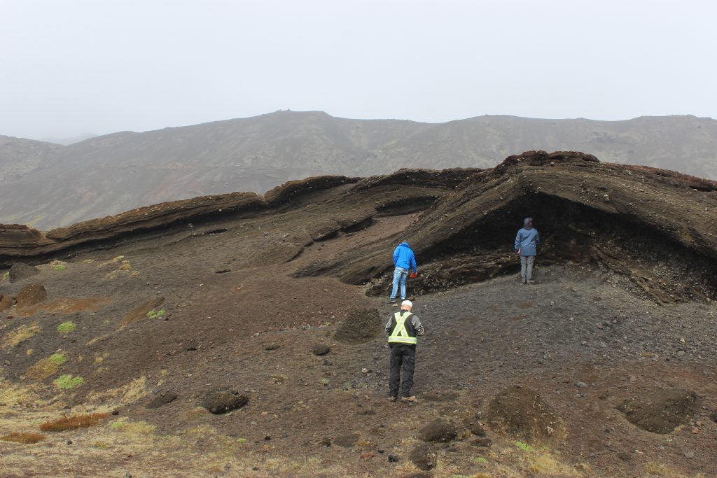
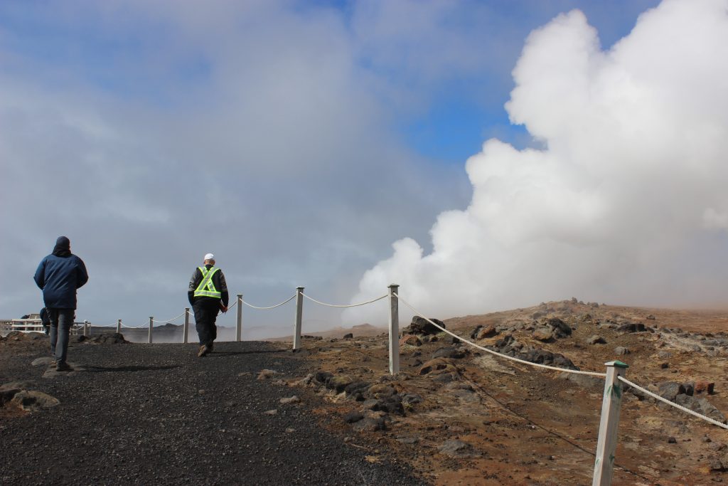
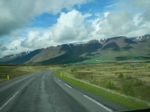
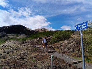
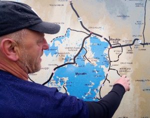
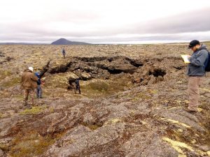
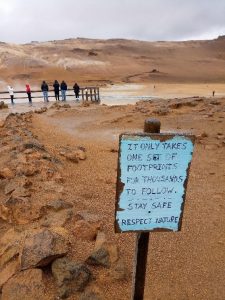
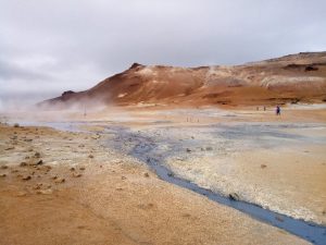
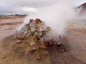
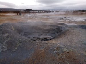
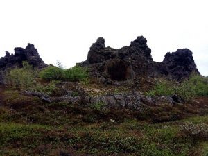
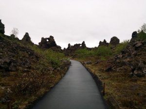
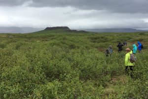
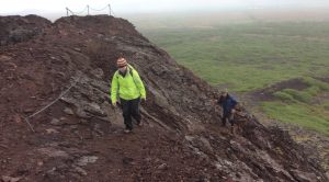
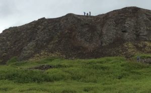
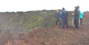
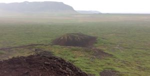
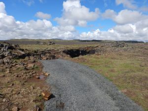
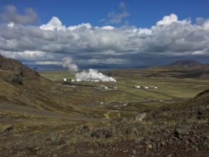
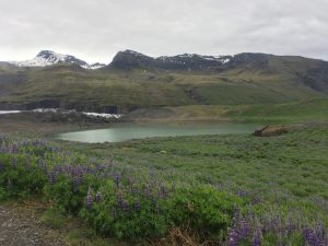
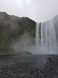
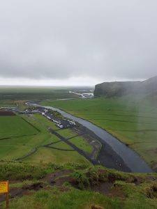
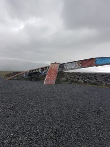
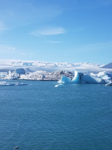
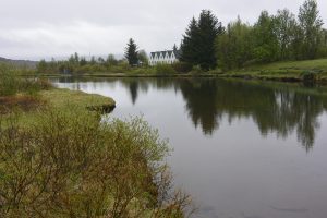
The drive continued south thought some amazing upland valleys, past the ends of fiords and along the edges of large braided rivers.  We eventually arrived at the third stop a series of two almost perfect scoria cones with recent basalt lava flows emanating from their craters, both that had been breached.  This was a national monument with a well-developed trail system and some excellent explanation boards. ( A distinct contrast to the previous days in Lake Myvatn area, where tourist infrastructure was definitely missing in the mud pools.)  The sun was out, the breeze was blowing and the sights amazing – Iceland at its best.

The climb up to the scoria cone

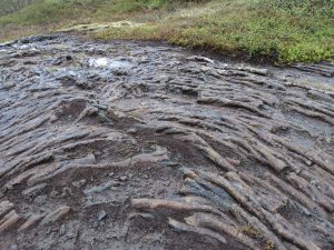
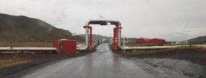
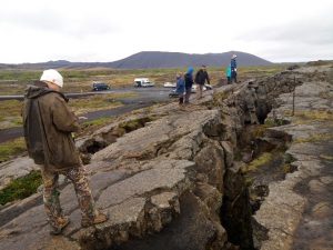
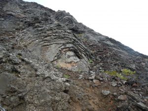
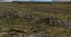
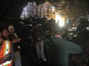
After a quick stop in Borgannes, it was on to the last leg of the journey through the 6 km and 1000 krone ($14) toll tunnel to the last stop – a series of sub vertical dikes in a sequence of Pleistocene lavas.  A quick race to the dykes up a steep slope by two volunteers confirmed the composition of dikes as mafic and the surrounding basalts flows with column structures.

Mafic dykes in slopes on south side of tunnel

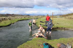
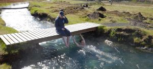
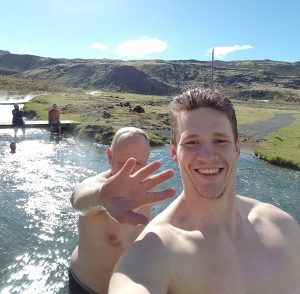
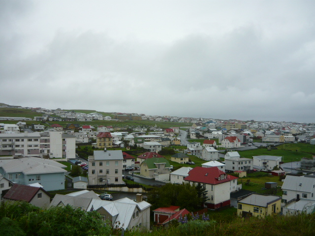
A short drive, before arriving in Reykjavik and the search for the City Hostel located near the Iceland International soccer field, a large camping site and of course the geothermally heated swimming pool.  Dinner at the local fish restaurant include: burgers, one whale steak, haddock and shrimp.  A night out for some to see the late (or early) 1-5 am nightlife of downtown Reykjavik and a dip in the swimming pool for others.

The comfy bus ride ends?

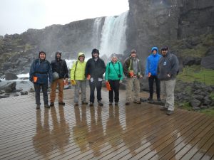
The trip is at an end with some flying out the next day, others staying one more night and one staying in  Iceland 10 more days to see more.  What a great way to spend 10 days in the field with  some of the most active geology in the world.  Looking forward to the next visit to Iceland already!

The Iceland Team of eight. Note, the two way up the slope near the bedrock bluffs and dykes.

Day 9 Mývatn Lake Area

We started our 9th day with a short drive out east to the Myvatn Lake area. This region is packed with lots of geological goodies. We could have spent another day but had to cherry pick our stops. We took advantage of a lookout info map coming into the valley in order to get our bearings.

Getting an overview of the area

Our second stop of the day was where historic lava flows meet the Myvatn Lake. Here we found a collapsed lava tube and got to peek into the flow. The Krafla rift system is at least 300,000 years old, with many layers of lava flows and explosion craters. There are two historic flows in the area, the older being the Myvatn flow, dated 1724 to 1729. The Krafla Fires, the most recent eruption, occurred from 1975 to 1984. During these eruptions, magma was forced along fissures in the ground and erupted out along the surface as lava. Nine times during the Krafla Fires lava erupted onto the surface. More frequently the molten rock stayed within the fissures below ground. Throughout this time, magma filled the magma chamber below the surface and later erupted, causing the ground level to rise and fall respectively. It is estimated that 250,000,000 m3 of lava was erupted during the Krafla Fires (approximately 100,000 Olympic sized swimming pools). (from the Krafla Power Plant interpretive signage, 06/04/2017).

Part of a collapsed lava tube

Our next stop was Leirhnjukur (clay hill), where geothermal fluid has altered the basalt to clay and other geothermal minerals. There was supposed to be some rhyolite around here but we didn’t get to see it. Despite the hotspring water being boiling hot, the day was very cold. Aaron even put a coat on! Highway reports put it at 4 degrees C before wind chill.

Leirhnjukur (clay hill)

Very generally speaking, the geothermal fluids break down the basalt rock in the lava fields to create new colourful geothermal minerals; such as grey clays, yellow Sulphur, rusty red iron oxide, and white silicate minerals. Below shows where the geothermal area meets the Krafla lava flow.

Where the geothermal area meets the lava flow

With the weather and timing, we decided to cut our trip to the Viti Maar short and just snap a selfie. At least we got out of the car. Another tourist there just sent his drone to view the explosive crater that formed in the 1724 eruption.

Selfie at Viti Maar
Selfie at Viti Maar

Our next stop was to the Krafla Geothermal Power Station to warm up. This turned out to be quite an informative stop and we learned much about the technical aspect of generating electricity from geothermal water. The Krafla Geothermal Power Station is Iceland’s first and still the largest power station in the country. It currently produces about 500 GWh annually Construction of this power station began in 1974, but delays due to the Krafla Fires put back the official launch until 1977. (https://en.wikipedia.org/wiki/Krafla_Power_Station, accessed 06/06/2017). According to the interpretive signage at the power plant, 99% of the electricity produced in Iceland is renewable, being mostly either geothermal power or hydropower. They continue to innovate, with future ideas involving deeper wells and hotter water. Below is a shot of the different drill bits used to drill a geothermal well, as well as their method of dealing with a road-pipeline intersection.

Drill bits
Drill bits
Diverted pipeline
Diverted pipeline

Next stop was the mud pots near Namafjall Mountain. Námafjall is a very hot (80-100°C!) geothermal area just south of the Krafla geothermal power plant. Tourists flock to this little roadside stop to see its fumaroles and mud pots. It was quite beautiful with all the hydrothermal minerals. The tour busses were providing their patrons with little booties which would have been handy in keeping all the mud and clay off of our boots. We just went ‘low tech’ and used a handy puddle.

Stay on the trails!
Stay on the trails!
Namafjall Mountai
Namafjall Mountain

Besides basalts being broken down into fun new minerals, there were many fumeroles venting into the air. Along with steam, the fumaroles release hydrogen sulfide gas, which gives the area a particularly pungent smell if the wind has died down. In the past, Sulphur was mined from areas such as Námafjall to be used in the production of gunpowder.

fumarole
Fumarole
mud pot
Mud pot
sulfur vents
Sulfur vents

Next stop was a rift called Grjotagja Cave. This one has a hotspring inside that was popular for bathing in times gone by but the Krafla eruptions increased the temperature so a dip in it now would not be fun. We were there for the geology but the tourists also like to come here as it was part of a scene in the popular Game of Thrones TV series.

A rift called Grjotagja Cave
Grjotagja hotspring
Grjotagja hotspring

Time being short, we decided to give Hverfjall crater a miss and skip over to Dimmugorgir.

Dimmuborgir is a labyrinth of towers that formed within a lava lake as the lava moved over water. The heated water generated steam which escaped up and formed towers. The towers were left behind as the lava lake was breached and remaining lava flowed out into channels.

a labrynth of towers
A labyrinth of towers

There is a local legend about 13 troll brothers who live in Dimmuborgir and come out during the Yule season; sort of like a baker’s dozen of Santa Clauses. These characters have funny names like ‘Spoon Licker,’ ‘Sausage Swiper,’ and ‘Door Slammer.’ When they come out of their caves in winter to get ready for Christmas, you might spot them along the trails. (Taken from local interpretive signage and http://www.visitmyvatn.is/en/about-m-vatnssveit/winter, 06/06/2017)

The 13 troll brothers

At this point we were running late so had to do a quick lap through the labyrinth (with only a couple wrong turns) and head ‘home’ to Akureyri.

Day 8 Snaefellsness Peninsula


Snaefellsnes Peninsula is the area where Icelanders have their vacations, and the area is a geological smorgasbord.  Unlike the rest of Iceland’s black sand basalt beaches, here the sands are often white and golden, indicative of their felsic (andesite and rhyolite) origins. However we decided to cut short our Snaefellsnes leg because we had a long 5-hour journey north. There is only so much driving Tim should be doing every day, and arriving at base camp at midnight doesn’t leave enough time to eat and dry out the clothes and gear. Darkness however is never an issue, because there is 24-hour light, so it is easy to lose track of time. The previous night we decided to limit Snaefellsnes to only Myrar in the morning, which is on the southeast approach to the peninsula.   Fortunately, there sits Eldborg crater, the finest example of a spatter cone in Iceland.

A sheep dog instructional session.

Before the morning hike starts, our sheepfarmer host treats us to a sheep dog instructional session for a young pup. Highly entertaining. This young dog was every bit as energetic and determined as many in our young crew. Sheep are as omnipresent in Iceland as lava. There are also herds of domestic horses, but no cattle. Icelanders eat mutton, lamb, fish and horse.   All are on the menu. Beef is rare. Vegetables are imported, although the geothermal presence is making some greenhouses viable up here at the Arctic Circle.

Our intrepid crew sets out for Eldborg

The hike is about an hour through birch bushes growing on a lava field. Eldborg is 5000 years old, almost a perfect ellipsoid, 180m X 250 m, 50 m high, with a steep 40 – 60 degree slope.


Jess and Tim climbing to the top.

The entire hike is across one of Iceland’s many lava fields. Actually, Iceland is one big lava field, which is only occasionally covered with enough sediments to create a soil, which if thick enough, creates the incredibly fertile agricultural base for which volcanoes are famous. Here the lava field varies between aa lava (blocky, chunky, jagged) further out, and pahoehoe lava (smooth, ropy, braided) closer in.  Both types made excellent stair material for our climb up.


The young men reach the summit.

That lead group is almost always Payton, Alex, Myles and Toby. This picture is three of those four, although the fourth has got to be in there somewhere.  Our spatter cone is the biggest in a sequence of five that aligns east-west, the same alignment as the en echelon fissure zones of the Snaefellsness peninsula.

Tim instructs while walking along the edge of the inner caldera.

Tim usually gets it right, but one thing geologists like to do as much as looking at rocks, is to argue about rocks, so opinions, opposition and alternative explanations are always welcome.  The rain is absolutely pouring here, and the wind is blowing hard.


Lava layers on the sides of the cone.

The center crater of the spatter cone was a lava lake, and the bubbling and splashing would lap the edges, leaving a series of lava layers on the sides of the cone.  Myles commented that this process creates the same appearance as the very different exfoliation of granite.

Cinder cone adjacent to our spatter cone to the SSE.


This is a cinder cone adjacent to our spatter cone to the SSE.   The cinder cone also has a central vent (sometimes large enough to be a caldera). The cinder cone tephras (ash and rocks ejected by the volcanic vent in the centre) are here smaller, lighter, and more vesicular (riddled with holes) than the tephra at the top of our spatter cone.


Now we have returned to Borgarnes and are heading off on our big trip north. Here we have the Borgarfjordur anticline. Notice how the tree-lined ridge in the middle distance slopes steadily to the left (east).  This represents the eastern limb of the anticline.

Similar to Hawaii, Iceland is formed by a mantle hot-spot. However in Iceland’s case, the mantle hot-spot intersects the Mid-Atlantic Ridge, where the oceanic bottom spreads apart in a rift, an underwater volcanic chain, where ~ 90% of the world’s volcanoes exist. Iceland is composed of a series of rifts, some active, others inactive or extinct.   On Iceland, these rifts form large rift zones which jump eastward 100 – 200 km every few million years. The hot spot is relatively stationary, but the plates move, so the rift zones migrate east.  The hotspot center is currently under Vatnajokull, the great ice sheet in eastern Iceland.  The Borgarfjordur anticline is important because it is the high ground between two rift zones, which confirms the location of a rift jump.


Toby checking dip and dip direction of a dipping lava flow that is likely related to a rift jump.

Toby’s project is studying the timing of these rift jumps (by analyzing rock ages and locations of rifts zones). Here Toby is checking the location, dip (slope), and direction of a rift jump. Toby is showing perfect posture for this task – notice the straight spine and the deep crouch.


Toby measuring yet another rift jump!

Callie commented on a previous blog that geologists love rocks and that is very true. Here Toby is indulging in his vocation, studying a rock. Toby is not actually wearing camouflage, but is rather undergoing the initial stages of lithification, whereby everything on the earth’s surface, including Toby, eventually turns back into rock. Of course, when we see this we always interrupt the process, but really we are only deferring the inevitable for some later time.


Day 7 A Visit to the Hveragerði Geothermal Area

Day seven began with an early departure from the town and island of Heimaey, the largest and only inhabited island in the archipelago of Vestmannaeyjar, commonly referred to as the Westman Islands. The day began smoothly, despite one of the students boots having been mistakenly taken by Tim. The sunny weather permitted views of the islands that were not available during our trip to Heimaey two days prior, also allowing a much more comfortable ferry ride back to southern Iceland as many of us felt quite sea sick on the trip out.

Heimaey Island from the Vestmannaeyjar Herjólfur ferry


Heimaey Island from the Vestmannaeyjar Herjólfur ferry


The first stop of the day was at a relatively well preserved lava tube known as Raufarhólshellir. Despite being closed since December due to the nature of previous self-guided tours proving quite damaging to the area, Tim managed to convince some of the tour guide staff to allow us to enter for a quick view of this phenomenal volcanic feature. The volcanic textures and apparent series of flows provided us with insight into how these type of structures form, and what they can tell us about previous volcanic events. The lava tube originally formed approximately 5,200 years ago, and is comprised of somewhere between 10-15 layers of volcanic flows. It is believed that the eruption lasted around two years, resulting in the main section of this feature extending about 950 meters long. The staff informed us that the land owner has decided that the cave would now have restricted access to limit damage and littering in the lava tube.


Entrance to the Raufarhólshellir lava tube


Inside of the Raufarhólshellir lava tube showing the barricade used to restrict unwanted access


 The group inside the entrance to the Raufarhólshellir lava tube


The next site we visited was the Hellisheiði geothermal power station, owned and operated by Orka Náttúrunnar (ON Power), which roughly translates to Our Nature, a subsidiary of Orkuveita Reykjavíkur (OR), or Reykjavik Energy in English. The plant is located within the southern portion of the Hengill volcanic system. This power station is the largest geothermal power plant in Iceland, and the second largest geothermal power station in the world. The bedrock in this region is mainly comprised of basic to intermediate extrusive volcanic rocks of the pre-historic (prior to the settlement of Iceland) Holocene geological epoch. At this geothermal plant, hot water can be extracted from geothermal sources and pumped to the nearby communities for both heat and hot water usage. Approximately 99.9% of the homes within Reykjavik and the surrounding area are heated geothermally. Additionally, these geothermal fluids can be to produce electricity in a similar fashion to how steam engines produce energy. The processes responsible for producing these hot fluids within the subsurface are directly related to Iceland’s tectonic and geographic placement, directly overlying both the Mid-Atlantic Ridge, and a stationary mantle plume. A self-guided tour of the facility helped explain the various contributing factors to Iceland’s world renowned geothermal capabilities. A brief film explained that approximately one third of Iceland is underlain by active volcanic zones. The video explained how energy is extracted as steam and water, and is used to provide both hot water and electricity to nearby communities.


The entrance to the Hellisheiði Geothermal power station


One of the problems with geothermal electricity production are the by-products hydrogen sulfide (H2S) gas and carbon dioxide (CO2) gas. Despite the misconception that there is very little that can be done with these gases in a sustainable timeframe, Iceland’s primary energy providers have proven that these gases can be reinjected into fractures in the underlying basalt, which results in the crystallization of certain minerals (H2S -> Pyrite or Fools Gold & CO-> Calcite) within the span of two years. This allows gases that are harmful to the environment to be converted back into rock. This form of energy production has proven both sustainable, as geothermal energy is a renewable resource, and efficient as approximately 27% of the country’s total electricity is sourced from geothermal activity. Overall, these factors demonstrate how Iceland is a global innovator in both the harnessing, and utilization of geothermal energy.


Some of the components of the heat exchange system at the Hellisheiði geothermal power station


The final leg of our journey for the day was a visit to the northern section of the Hengill volcanic system which is host to the Nesjavellir geothermal power station. Also operated by Orka Náttúrunnar, the Nesjavellir geothermal plant is the second largest geothermal power station in Iceland. Although we were not provided the opportunity to tour this facility, the surrounding region was abundant with well-marked hiking trails that provided an up close view of various geothermal vents and the volcanic rocks that make up much of Iceland’s geothermal areas.


 Overlooking the Nesjavellir geothermal power station from one of the many nearby hiking trails


One of the borehole stations located at the Nesjavellir geothermal power station


Despite common knowledge that the majority of Iceland’s bedrock consists of typical basalt, the basalt that appears in these areas does not fit this description. Many of the rocks have been significantly altered due to the presence of geothermal fluids, and are consequently quite variable in terms of mineralogy and texture. Along our hike, we observed two or more altered basalts that do not fit the characteristics of typical oceanic crust.


Toby and Byron getting a close-up look at some of the geothermally altered basalt within the region surrounding the Nesjavellir geothermal power station


The group pondering about the mineralogy of geothermally altered basalts near the Nesjavellir geothermal power station

Just before returning to the bus, Tim made the observation that a regional map displayed the presence of a nearby river that was geothermally heated and could be used as a relaxing place to take a dip. Despite our excitement to see more geology and exciting rock formations, we quickly seized the opportunity and jumped right in.


The group at a geothermally heated river near the Nesjavellir geothermal power station


Callie and Alex enjoying the warm waters of a geothermally heated river near the Nesjavellir geothermal power station

This provided a momentary break from our research and the various stresses of field school, and reminded us of the once in a lifetime opportunity that this trip was providing. This also provided Alex with a once in a lifetime opportunity to take a selfie with Tim.


Alex and Tim taking a selfie at a geothermally heated river near the Nesjavellir geothermal power station

The drive to our hostel in Borgarnes was relaxing and provided all of us a well-needed opportunity to sleep, except for Tim who has been stuck with the responsibility of driving nearly the entire trip so far. What a day!

Day 6 Heimaey

Heimaey Island is situated in the Vestmannaeyjar archipelago (Western islands) located in the southern region of Iceland.

Stop 1: Eldfell Volcano

After a long, arduous journey to the hostel we were warmed and rested, ready to tackle the day another day in Iceland. The day began with an early morning start with a hike up to the Eldfell volcano (220m in height) with less than optimal weather. As the hike continued on we gained altitude and we were exposed to stronger winds and the rain started to sting. Upon reaching the summit the visibility was lacking we ended the trek with a quick photo shoot. After a brief rest we returned to the hostel thoroughly soaked to eat some lunch.

The hike begins
Overlooking Heimaey
Imagine a volcanic crater here
Group photo of very happy geologists


Stop 2: Eldheimar (volcano museum)

Looking for a less wet activity we decided to attended the museum Eldheimar. At the museum we learned about the history of Vestmannaeyjar like the 1973 eruption of Eldfell and how the locals fought the oncoming lava flow to save the harbor and in the aftermath of the eruption the tephra that had fallen was then used to increase the surface area for the airport. There was also an exhibit on the formation of a new island Surtsey that came into existence in 1963 that has provided scientists a way to see how plants and fauna begin to inhabit new islands.

A ‘preserved’ house that was damaged by the 1973 eruption

Stop 3: Outcrop near soccer field

Here we looked at some upper Pleistocene rocks with steeply dipping beds likely the remnants of an older volcano. My notebook decided it wanted to fly away in the heavy winds the island was experiencing.

Upper Pleistocene rocks

Following this we went to the southernmost region of the island and we managed to spot an elusive puffin and experience the windiest part of the island.

A look at Heimaey when it is nice as we say goodbye

Day 5 On the Road to Vestmannaeyjar

We began Day Five with high hopes for the weather – the skies were clear and there was no fog to be seen. Our plan for the day was to travel from Vagnsstadir to Landeyjahöfn, where we would catch the ferry to Heimaey. We’d already done this drive once before on the way out to the east, but we still discovered new treasures along the way.

The first stop was at Svínafellsjökull, a small glacier off of the much larger Vatnajökull ice sheet. We parked the van (we’re still voting on nicknames) at a hotel near the highway and walked in on a well-groomed path. Our journey was about four kilometres round-trip and took us right to the edge of the glacier.

The group taking notes on the glacial landforms visible on the hike in.

Extrusive rocks from the Tertiary period (older than 3.3 million years old) made up the mountains on either side of the glacier, which could be found as boulders, cobbles, and pebbles within the moraines.

Lupine fields leading up to Svínafellsjökull.
A meltwater lake. Annual and recessional moraines, marking the past extent of the glacier, can be seen as linear sediment features behind.
Aaron and I basking in the glory of Svínafellsjökull.
Myles and Jessica below the glacier!
Group photo standing on the glacier – some more comfortable than others…

We continued our journey along the mother of all sandurs, Skeiðarársandur, whose straight roads and endless sand lulled the boys to sleep.

The endless sandur.
Nap time!

The further west we travelled, the worse the weather got. By the time we arrived at Dyrhólaey the wind was ruthless and the rain was coming down in sheets. However, as all geologists know, rain cannot keep the rocks away – or us away from the rocks! We unloaded and battled the wind to a lookout where we could see the black sand beaches and the sea stacks.

The black sand beach, Kirkjufjara and one lonely sea stack.

The bedrock of Dyrhólaey was deposited in the last 800,000 years as hyaloclastite and pillows lavas, with intercalated sediments. Holocene sediments create the beach and underly the lagoon nearby.

The boys fighting the wind at Dyrhólaey.

Due to stormy weather, cold hands, and having a non-4×4 vehicle (honestly, Tim’s driving had nothing to do with it) we could only view the sea arch from afar. We were not disappointed for long, as less than five minutes later we were blessed with a peculiar outcrop.

An outcrop of wind and water resistant ash deposits or tuff.

These ash deposits are very young in age (geologically speaking), known due to the fact that they’re still standing! The tuff shows extensive weathering and erosion by wind and meltwater. Soon enough the wind, rain, and geology students will have eroded the outcrop to sand.

Layering in the tuff.

Our last stop before the ferry was Seljalandsfoss, a waterfall just off of Highway 1. This waterfall is one of kind – you can walk behind it and view the falls from all angles! Seljalandsfoss exists on interglacial and supraglacial lavas with intercalated sediments. The sediment layers behind the falls have been eroded away, creating the depression behind the waterfall that allows us to walk around behind. By the end of our visit with Seljalandsfoss we were all soaking wet, from both the rain and the water spray.

Seljalandsfoss
Group photo around the backside of the falls. Can you guess who’s who?
A side view of the waterfall.

A bit tired, very wet, and ready for the next adventure, we boarded the ferry (nope, not BC Ferries) and arrived in the town of Heimaey, ready to rest and recuperate for the adventures of Day Six.

Day 4 Stokeness and Helvar: Searching for Rocks other than Basalt!

Today’s adventure lead us to areas near Hofn on the southeast side of Iceland. We were hoping to encounter some rocks other than basalt – which makes up over 85% of the island.  We were as usual surprised by what we found.

Our day started with the usual cool, fog and light rain.  On our approach to Stokesnes we decided to examine some of the oldest (Tertiary) rocks on Iceland – thickly layered basalt flows.

The oldest rocks in Iceland – Tertiary basalts

We clambered up a gully to the base of a small waterfall and found a series of layered basalt flows, separated by a thin shale bed and a thicker conglomerate bed below.  This confirmed what we saw on the map legend that mentioned inter-bedded sediments, and also the bluffs themselves with the basalt layering highlighted by the more recessive sediments.

The amphitheatre-like landscape at Stokeness.  The setting for the Viking camp

It did not take long to arrive at Stokeness – a peninsula surround on both sites by elongate spits and interesting lagoons.  After paying to enter the area (that is part of a private farm) we hiked into an amphitheatre-like setting where high mountains and bluffs with steep scree slopes leading down to a grass and wetland area adjacent to the lagoon.  At the base of the slope we checked out a mock Viking encampment that had been constructed in the 1990’s for a movie set, but never used.  A good discussion of how a Viking must have lived ensued.

Aaron apturing notes during a field lunch break

From scree slopes and nearby outcrops we encountered a combination of intrusive rocks – diorite, gabbro and a possibly a quartz diorite?  There was some suggestion that these intrusives were emplaced into each other, but their relationship to the surrounding and oldest rocks of Iceland – the Tertiary Basalts was still a but if a mystery.  However, from looking at the bluffs on the access road to Stokeness we did view a conclusive instructive contact between these basalts and the quartz diorite.

Friendly locals!

Part of our hike took us through group of five of Iceland horses who seemed friendly enough and were willing to be petted – even by Alex.  However, we decided not to share our lunch as the rest of the herd of thirty might have joined us.

Black sand dunes at Stokeness

Before leaving Stokenss, we examined the shoreline (near an old US Radar station) and encountered some more gabbro outcrops with some amazing coarsely crystalline pegmatite pods.  We also found some black sand dunes, where sand from the beach was swept up to edge of the lagoon.  There was some discussion as to wind direction and the asymmetrical shape of the dunes, which appeared vegetated on the windward site.

Intrusive rocks at Helvar

To finish the day we decided to head a little further east towards another headland at Helevar, where a second intrusive complex was reported to occur.  This started to appear to be less interesting as sometimes happens in geology.  However, we moved a little further along the road and suddenly encountered a series of spectacular outcrops in the middle on a black sand plain.  On closer inspection we found that we were at the contact between a gabbro and a quartz-diorite intrusives with xenoliths and cross-cutting veins (described by one member of the group as a ‘Dalmatian Explosion’).  Finished for the day we headed back to our hostel for the evening that appeared to full of people from all over the world – China, Israel, Germany and Vancouver Island (UVic students)!

Day 3 Glaciers and Sandurs!

After packing up the van at the Selfoss Hostel we headed due East towards several small icecaps, radiating outlet glaciers, and their extensive sandur deposits. Our first stop was at the Eyjafjallajökull information center on the side of highway 1 which provided us with a timeline of eruptions from the sub-glacial volcanoes of the Eyjafjallajökull, and Mýrdalsjökull ice caps, along with information about the 2010 eruption that caused major airline closures.

Landscape
View from the Eyjafjallajökull information center, just imagine a beautiful glacier behind the fog.

From there we went and witnessed the beauty of the close by Skógafoss Waterfall. The waterfall is 15 meters wide and falls off a 62-meter cliff into a massive plunge pool. It’s fed from melt-water making its way down from the Eyjafjallajökull glacier. This extreme topographic drop is formed from marine erosion after the last ice age when sea level was much higher due to the addition of melt-water from the ice, and weight of the ice sheet that had depressed the land. With the loss of ice, iso-static rebound gradually raised the land out of the ocean, exposing the cliffs, and creating the extensive sandurs that we see now. From a distance, we could see successions of pillow basalt, pillow breccia, and hyaloclastites, making up the waterfall cliff.

The Skógafoss Waterfall.
View from the top of the waterfall, looking over the river drainage system.

At our next stop, we finally opened our eyes to one of Iceland’s many beautiful glaciers, the Sólheimajökull glacier, extending for 14km as an outlet from the much larger, Mýrdalsjökull ice cap (600km2). Here we were able to see a number of formations within the glacier, in front of, and along its margins. The most evident were the medial moraines within the glacier, lateral moraines along its edges, and recessional moraines throughout the present out-wash plain. Driving up to the glacier, we could see the full extent of the out-wash plain formed from jökulhlaup’s which have reached up to 1700m3/s (1999).

The terminus of the Sólheimajökull glacier.

Next, we made two quick stops on the side of the highway to see a couple voluminous basaltic lava flows which occurred in Iceland’s historic era (870 AD). These covered a large area of the Mýrdalssandur formed from the 1798 Laki fissure eruption, north of the sandur plain. The flows were also covered in extremely comfortable moss, allowing for us to truly enjoy the geology by having a quick lie down.

The what seems to be endless historic basalt lava flow, covered in the thick luscious moss.

After realizing the drive to our next hostel was farther than anticipated, we had to make quick of two more stops. The first, was on the side of the highway where there was a bridge wreckage display from a devastating jökulhlaup on September 30th 1996, lasting until October 13th. This jökulhlaup was formed from a fissure eruption located within the Vatnajökull ice cap, and was released from underneath the Sioujokull glacier. The bridge was made to withstand flooding waters up to 20 000 m3/s, however the resulting flooding water from the jökulhlaup was 45 000-50 000 m3/s, at its peak flow.

Display of the bridge wreckage of 1996 on the Skeidararsandur.

Our final stop was at the Jökulsárlón lagoon radiating from the Breioamerkurjokull glacier, which made for a spectacular end to the day as the sunshine graced us. This lagoon was host to many large icebergs that have been calved from the front of the glacier as it recedes. The tide controls the flow of water from the lagoon, during a falling tide, water will flow from the lagoon into the ocean, and at rising tide, from the ocean into the lagoon. This lagoon is site to some of the most recent and important climate change research; which looks at the effect of global warming on glaciers and their surrounding environment.

Amazing view of the Jökulsárlón lagoon at the terminus of the Breioamerkurjokull glacier.

On a final note, it was amazing to see large scale basaltic flows, real-time glacial processes, and jökulhlaup outwash plains, to provide context to some of the theoretical geological processes and features that we learn so much about back at VIU.


Day 2: Journey to the Golden Triangle of Iceland

Today we got a late start to our day as Tim  made an early run to Reykjavik to pick up our long lost comrade Aaron Doan, who missed his connecting flight in Edmonton due to heavy fog. After a brief safety discussion and reconfirming our route for the day we headed off to explore the wonders of the Golden Triangle of Iceland.

Route used for Day 2
Thingvellir National Park

Leaving our hostel at Selfoss we headed north to Thingvellir National Park. On the way we took in the beauty of the area by observing Iceland’s largest lake (Thingvallavatn Lake) and views of lowland basaltic lava flows flanked by snow capped mountains. Upon reaching our first destination, Thingvellir National Park we managed to find some free parking on a gravel side road where we proceeded to hike into the southern section of an area referred to as the Western Rift Zone. It’s hard to believe the geologic time scale we are looking at with the formation of these rocks as they are considerably younger than the Karmutsen basalt we are used to seeing on Vancouver Island. The geologic unit of this section of the rift is considered to be part of the Holocene, a post glacial prehistoric era greater than 871 AD in age.

Stop 1: Thingvellir National Park

Group photo, a majestic water fall flows over the western edge of the main rift where a normal fault appears to have directed the water to this location.
From the photo above you can see how the dip angles of the secondary rifts change to opposite to the larger rift in the foreground.

From the waterfall we walked south about half a kilometre to get a bird’s eye view of the entire rift zone in order to fully appreciate the enormity of this structure.  The overall width of this rift zone is approximately 15 kilometres wide, west to east.

Tim taking strike and dip of the pahoehoe lava flows along the rift zone.
Along the way some lighter moments were had as Alex demonstrates the “selfie” and gets a laugh in with Myles captured in the back ground
Thingvellir National Park

Thingvellir National Park is also a site of historical and cultural significance. Icelandic settlers established a farming community in  this area as well as set up a judicial system in 930 AD where problems were adjudicated among the settlers. Iceland claims this is where democracy was first born , however we think the Greeks might have something to say about this…In 1262 AD the Norwegian King took control of Iceland and introduced Christianity to Icelanders. This church at Thingvellir was established in 1867 and was operated until 2016. Today it marks a historic site for the people that settled in this region.

Pa-hoe hoe lava flows

On our way back we got lost and ended up trekking through the rift valley where pa-hoe hoe lava flows were observed on trails that cut through thick moss beds and shrub brush.

Sitting in a secondary rift zone

Part of getting lost is finding really cool formations. Here I’m sitting in a secondary rift zone where columnar basalt’s are observed to have formed in the center of the rift zone.After re-orienting ourselves we managed to find our van and head east to the the town of Geysir, a site of hydro-thermal activity where hot springs and geysers were observed.

Stop 2: Geysir and Strokkur

Here a hot spring is observed with steam rising from it’s boiling waters as well as the precipitation of white minerals (sinter) formed from high concentrations of silica within the fluids and red minerals formed from iron oxidation.


Myles discusses how geothermal vents, and geysers are indicators of the precipitation of low sulphide gold and silver mineralization. However, these systems appear too young to have had the opportunity to form these minerals.


Here is the Strokkur geysir  putting on a spectacular display, faithfully erupting every 5-10 minutes.  https://viuvideos.viu.ca/media/Strokkur+Geyser%2C+Iceland/0_umskoyas

After spending some time admiring the hydrothermal springs and Geysir Strokkur we decided to continue to the east.

Stop 3: Gullfoss

The falls of Gullfoss were impressive and much larger than we imagined. At one time the falls were to be leased for power generation but the deal fell through and ever since the area has been a protected park.


Here Tim sizes up the massive waterfall and contemplates the faults that make up the multiple steps that redirect it’s flow.


A better view, and the scale of this massive water fall becomes apparent. The falls appear to be directed by a major fault intersected by secondary fault that changes the direction of the flow. The lower section of the water fall is later directed into a large rift zone.

What we learned today was that the scale of the Western Rift Zone is locally very complex and not as simple to understand than it first appeared.


Day 1 Reykjanes Peninsula!

After rallying the students in Rekyavik, it was time to head south to the fresh volcanic landscape of the Reykjanes. Immediately upon leaving Reykavik, we were surrounded by rugged volcanic features ranging from 0.8 million years old to just 600 years old.

Example of a typical volcanic landscape in Iceland.

The first scheduled stop was at Lake Kleifarvatn, Iceland’s deepest lake. Although not visible without diving, there are geothermal vents at the bottom of the lake.

The students, and our trusty van with Lake Kleifarvatn in the background.

While the lake might transfix your average person, we immediately ran off to the west side of the lake to an outcrop of cemented volcanic ash with muddy layers.

Volcanic ash layers on the side of the road.

Further south, we observed the geothermal area of Krysuvic. This area featured radically altered landscapes due to the interaction of heat and water with the rocks. The heat and water have changed the appearance of the rock from black to a variety of vibrant colours such as yellow, white, red, and orange.

Students examine the geothermal steam, hot springs and various coloured minerals.
Tim gazes at the various brightly-coloured minerals of the Krysuvik hot springs.

The group then carried on down the southern coast of the Reykjanes peninsula, eventually arriving at another geothermal site, called the Gunnuhver Hot Springs. This site is near a geothermal power plant where the steam is used to produce electricity for Iceland.

Toby walking up to the steaming Gunnuhver hot spring area.
A view of the geothermal system with the hot springs and a geothermal power station to the left.
Another example of geothermal minerals at Gunnuhver Hot Springs.

Our last stop for the day was the location of the spreading apart of the North American Tectonic Plate and the Eurasian Tectonic Plate. This is one of the few places where this spreading can be observed because the vast majority of the rift is located on the bottom of the ocean.

Tim geologizing by the North American Plate boundary. The Eurasian plate can be observed on the opposite side, on the right side of the picture.
Payton wandering between the continents.

We then ended our day in the town of Selfoss, where we’ll begin our trip to the Golden Triangle tomorrow!