Introduction
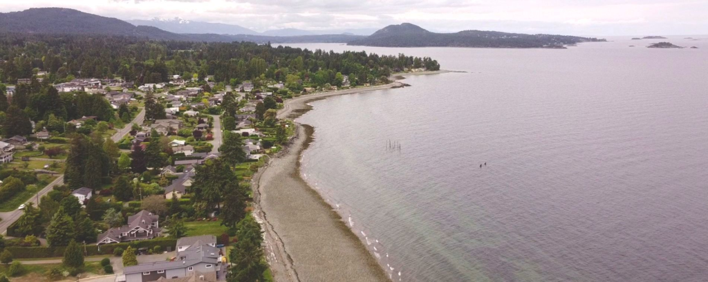
In this field trip we headed off to Lantzville to assess how properties on the shoreline were mitigating the effects of sea-level rise on their properties. This trip gave a lot of insite on the various methods used (both past and present) and the discussion of land-use planning on coastlines.
Background
Lantzville is a small neighbourhood in the North of Nanaimo were many residences line the beaches. Many of these properties have been around for many decades and the rising sea levels and more occurence of storms have caused some issues in the area.

The Trip
We hopped on the bus and headed North to Lantzville. We were disappointed with the fact that the expert on soft shorline protection was unable to attend. But luckily, we were led by the one and only Dr. Tim Stokes! We stared with a brief overview of the area then headed down to the beach. This was my first time there and it was real nice. I’d put a house down there for sure (using proper soft shoreline protection of course).
At the beach we were able to see the various kinds of mitigation practices that are in use. These practices varied from property to property. The first one we checked out was simply a 1 metre high concreate will with some pipes within for drainage. This one was not very appropriate as it caused a negative effect on the rest of the beach by altering sedimenet transport and natural ocean movments. It was also the most unsightly.

The second, and most common method along the beach there in Lantzville was the use of boulders, logs, and other vegetation to create a more natural looking “wall”. This technique was the best looking in the area I’d say as it looked somewhat natural. When you took a closer look you could see that the logs were tied in to prevent them from moving during a high tide event.

Another wall we saw was similar to the first one except it appeared more as a conglomerate style wall. This wall was heavily fractured and obvious signs of mending and reinforcing were seen. An interesting aspect of this one was the fact that it was resting on top of a layer of visible coal waste from past mining operations in the area.

On our way back out to the bus, we were stopped by a friend of a property owner on the beach. This man was very confusing and had a wierd sense of humour (he was most likely english of some sort). But apart from that he had a lot of information to tell us. He told us that in the past, property owners found kind of a loophole in the system in which they could infill into the shorline and therefore extent their property further out. The area in which the past high tide line occured actually lies right at the back doorstep of most residences. Ummmmm thats not good!
After the Lantzville portion of the trip we headed down to Pipers Lagoon to take a look at a green/soft shore project that occured there. This site was far different then what was seen in the North. In consisted of a larger buffer zone (roughly 6 metres deep) that was full of rocks, stumps, logs, and native plants that are acustom to periods of time in the presence of ocean water. Along with the beach side of the property undergoing some change, the paved driveway was also replaced by pervious gravel to improve site drainage.


Conclusion
This trip provided a lot of insight into shorline protection of the past and the future. It allowed us to see how construction of certain features may benefit homeowners temporarily, but overall nature will overcome those features and therefore create further problems. The ultimate way appears to use green/soft shore practices to allow for natural high tide processes.
