Below are brief details of some ongoing and recently completed research projects, including links to completed reports & maps in PDF format.
1) Water Stress on Vancouver Island (2023-2024)
The water balance model for Vancouver Island (see below) provides a basis for quantifying how water moves through the environment using a simple model that has the capability to document the variability in hydrology on the Island. In this project a model of human water use will be developed so that water stress can be calculated, to see where and when the water system is stressed now, and how that might change in the future. This will provide a tool to help manage water resources into the future.
2) Water Balance for Vancouver Island (2018-2023)
During the 2018-2019 academic year I was on assisted leave working to develop a water balance model for several watersheds on Vancouver Island. The research examined geographically diverse watersheds including small and large, and those whose hydrology is dominated by rainfall (pluvial) and both rainfall and snowmelt (hybrid). The model does a good job of replicating the existing hydrological flow regimes on the Island, and was used to predict how this might be affected by global climate change, using different scenarios available via ClimateBC. Reporting is in progress, I will post here when complete.
3) The Impact of Climate Change on Crop Water Requirements for Vancouver Island (2013-2017)
A model of crop water requirements, during the typically warm and dry summers on Vancouver Island, was developed using the ClimateBC compilation of historical climate data. The model quite accurately predicts historical crop water need, especially in eastern regions of the Island, and was then used to predict the consequence of climate change using a variety of climate change scenarios. The analysis suggests that crop water need, in the form of additional irrigation, will most likely increase by the end of the century and could double in a worst-case-scenario.
4) Vancouver Island Community Groundwater Monitoring Network (2012-2015)
This project created an online database to allow property owners with a groundwater well to record water levels to supplement the BC groundwater well observation network. The greater the amount of data that is collected and made available, the more we will understand the dynamics of the groundwater system, especially the connection to surface waters. This has been used as a template for other community-based initiatives to share information about water.
5) Vancouver Island Aquifer Classification Project (2011)
ADGISA practicum student Joel Kinzie created a comprehensive aquifer map of Vancouver Island building on the work completed during the VIWRVMP (see below). The project report is given at the links below.
6) Vancouver Island Water Resources Vulnerability Mapping Project (2006-2010)
This initiative has developed a series of maps to characterize intrinsic groundwater vulnerability on Vancouver Island using the DRASTIC method. The maps are being used as a tool to assist water-centric planning by Regional Districts on Vancouver Island.
Report-Phase 1, Report-Phase 2, Map – Classified, Map – Unclassified
7) RDN Area A Groundwater Study (2008-2010)
This project developed a water budget for Area A of the Regional District of Nanaimo to assess the concept of sustainability with regard to water resources. A major outcome was the development of a groundwater management strategy and BMPs to guide land-use decision making.
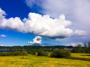
Impending rainfall on Vancouver Island, Canada.