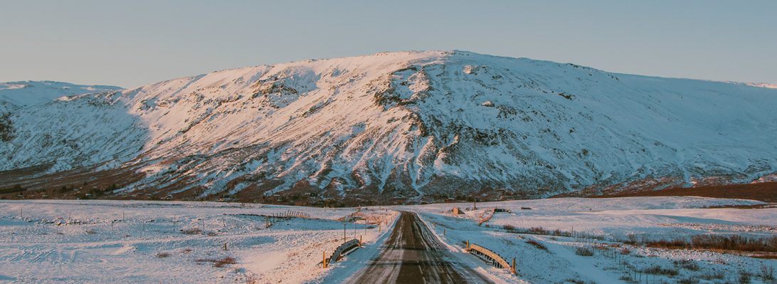
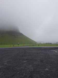
After packing up the van at the Selfoss Hostel we headed due East towards several small icecaps, radiating outlet glaciers, and their extensive sandur deposits. Our first stop was at the Eyjafjallajökull information center on the side of highway 1 which provided us with a timeline of eruptions from the sub-glacial volcanoes of the Eyjafjallajökull, and Mýrdalsjökull ice caps, along with information about the 2010 eruption that caused major airline closures.
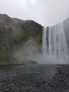
From there we went and witnessed the beauty of the close by Skógafoss Waterfall. The waterfall is 15 meters wide and falls off a 62-meter cliff into a massive plunge pool. It’s fed from melt-water making its way down from the Eyjafjallajökull glacier. This extreme topographic drop is formed from marine erosion after the last ice age when sea level was much higher due to the addition of melt-water from the ice, and weight of the ice sheet that had depressed the land. With the loss of ice, iso-static rebound gradually raised the land out of the ocean, exposing the cliffs, and creating the extensive sandurs that we see now. From a distance, we could see successions of pillow basalt, pillow breccia, and hyaloclastites, making up the waterfall cliff.
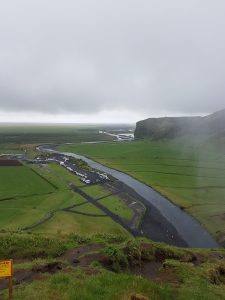
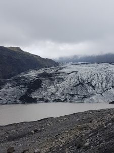
At our next stop, we finally opened our eyes to one of Iceland’s many beautiful glaciers, the Sólheimajökull glacier, extending for 14km as an outlet from the much larger, Mýrdalsjökull ice cap (600km2). Here we were able to see a number of formations within the glacier, in front of, and along its margins. The most evident were the medial moraines within the glacier, lateral moraines along its edges, and recessional moraines throughout the present out-wash plain. Driving up to the glacier, we could see the full extent of the out-wash plain formed from jökulhlaup’s which have reached up to 1700m3/s (1999).
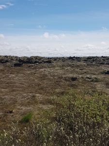
Next, we made two quick stops on the side of the highway to see a couple voluminous basaltic lava flows which occurred in Iceland’s historic era (870 AD). These covered a large area of the Mýrdalssandur formed from the 1798 Laki fissure eruption, north of the sandur plain. The flows were also covered in extremely comfortable moss, allowing for us to truly enjoy the geology by having a quick lie down.
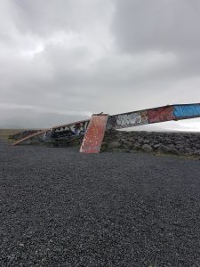
After realizing the drive to our next hostel was farther than anticipated, we had to make quick of two more stops. The first, was on the side of the highway where there was a bridge wreckage display from a devastating jökulhlaup on September 30th 1996, lasting until October 13th. This jökulhlaup was formed from a fissure eruption located within the Vatnajökull ice cap, and was released from underneath the Sioujokull glacier. The bridge was made to withstand flooding waters up to 20 000 m3/s, however the resulting flooding water from the jökulhlaup was 45 000-50 000 m3/s, at its peak flow.
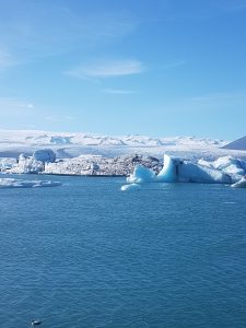
Our final stop was at the Jökulsárlón lagoon radiating from the Breioamerkurjokull glacier, which made for a spectacular end to the day as the sunshine graced us. This lagoon was host to many large icebergs that have been calved from the front of the glacier as it recedes. The tide controls the flow of water from the lagoon, during a falling tide, water will flow from the lagoon into the ocean, and at rising tide, from the ocean into the lagoon. This lagoon is site to some of the most recent and important climate change research; which looks at the effect of global warming on glaciers and their surrounding environment.
On a final note, it was amazing to see large scale basaltic flows, real-time glacial processes, and jökulhlaup outwash plains, to provide context to some of the theoretical geological processes and features that we learn so much about back at VIU.