Day 5 On the Road to Vestmannaeyjar

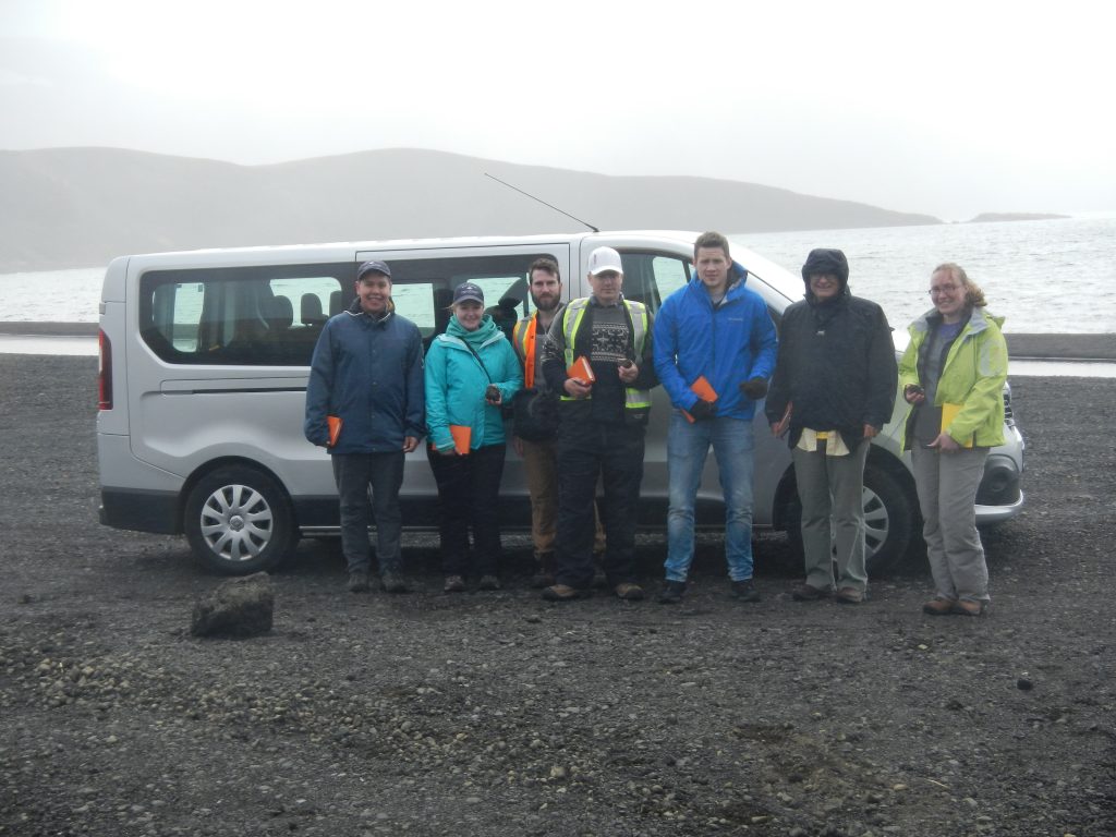
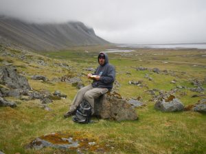
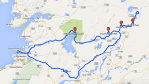
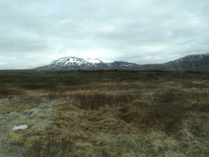
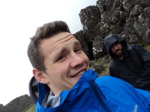
We began Day Five with high hopes for the weather – the skies were clear and there was no fog to be seen. Our plan for the day was to travel from Vagnsstadir to Landeyjahöfn, where we would catch the ferry to Heimaey. We’d already done this drive once before on the way out to the east, but we still discovered new treasures along the way.

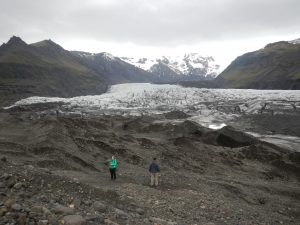
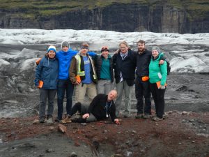
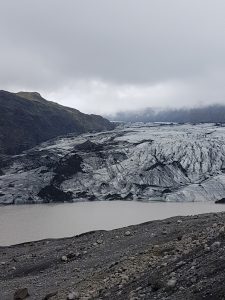
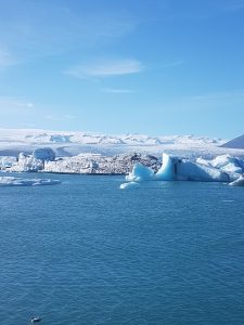
The first stop was at Svínafellsjökull, a small glacier off of the much larger Vatnajökull ice sheet. We parked the van (we’re still voting on nicknames) at a hotel near the highway and walked in on a well-groomed path. Our journey was about four kilometres round-trip and took us right to the edge of the glacier.

The group taking notes on the glacial landforms visible on the hike in.

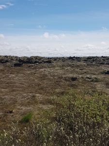
Extrusive rocks from the Tertiary period (older than 3.3 million years old) made up the mountains on either side of the glacier, which could be found as boulders, cobbles, and pebbles within the moraines.

Lupine fields leading up to Svínafellsjökull.
A meltwater lake. Annual and recessional moraines, marking the past extent of the glacier, can be seen as linear sediment features behind.
Aaron and I basking in the glory of Svínafellsjökull.
Myles and Jessica below the glacier!
Group photo standing on the glacier – some more comfortable than others…

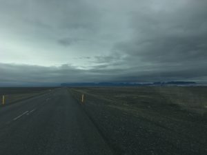
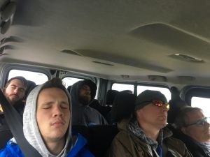
We continued our journey along the mother of all sandurs, Skeiðarársandur, whose straight roads and endless sand lulled the boys to sleep.

The endless sandur.
Nap time!

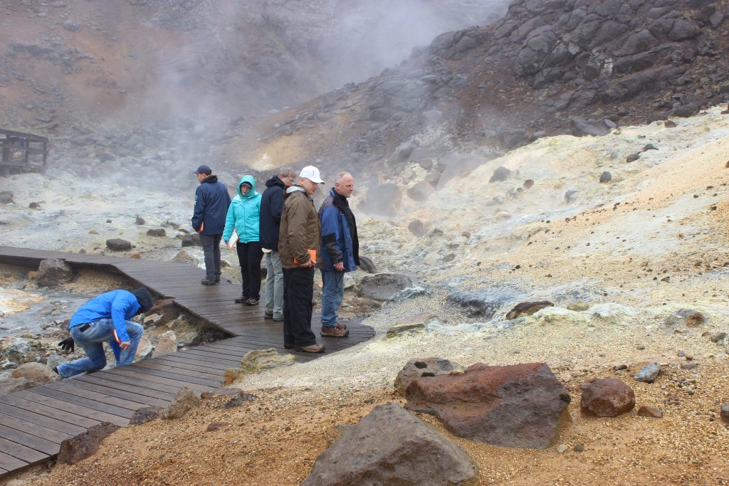
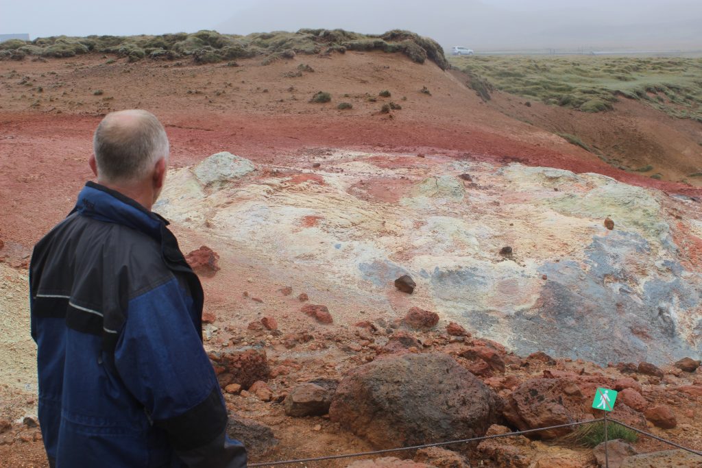
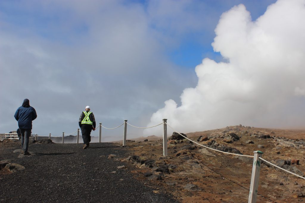
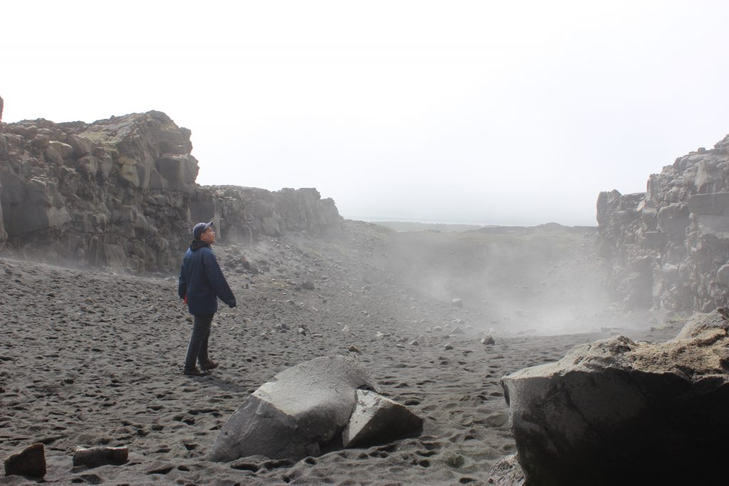
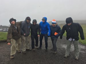
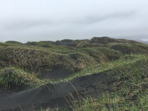
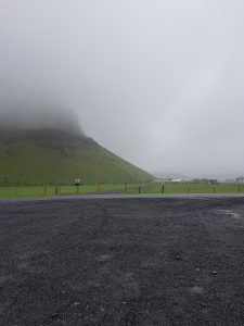
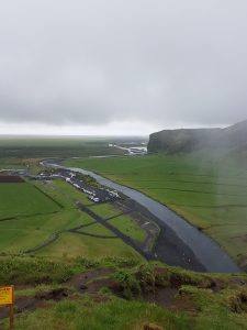
The further west we travelled, the worse the weather got. By the time we arrived at Dyrhólaey the wind was ruthless and the rain was coming down in sheets. However, as all geologists know, rain cannot keep the rocks away – or us away from the rocks! We unloaded and battled the wind to a lookout where we could see the black sand beaches and the sea stacks.

The black sand beach, Kirkjufjara and one lonely sea stack.

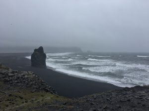
The bedrock of Dyrhólaey was deposited in the last 800,000 years as hyaloclastite and pillows lavas, with intercalated sediments. Holocene sediments create the beach and underly the lagoon nearby.

The boys fighting the wind at Dyrhólaey.

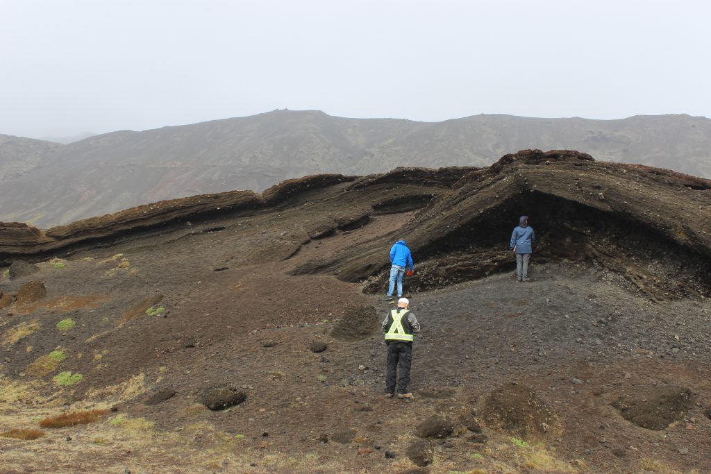
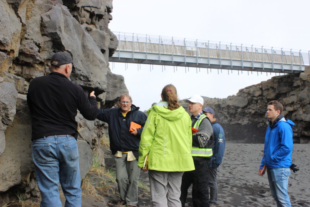
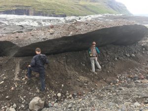
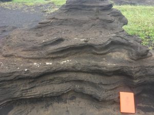
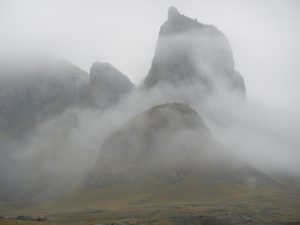
Due to stormy weather, cold hands, and having a non-4×4 vehicle (honestly, Tim’s driving had nothing to do with it) we could only view the sea arch from afar. We were not disappointed for long, as less than five minutes later we were blessed with a peculiar outcrop.

An outcrop of wind and water resistant ash deposits or tuff.

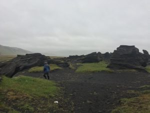
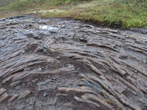
These ash deposits are very young in age (geologically speaking), known due to the fact that they’re still standing! The tuff shows extensive weathering and erosion by wind and meltwater. Soon enough the wind, rain, and geology students will have eroded the outcrop to sand.

Layering in the tuff.

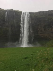
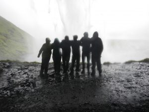
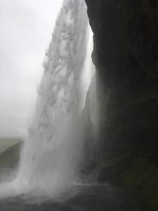
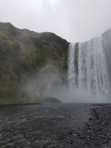
Our last stop before the ferry was Seljalandsfoss, a waterfall just off of Highway 1. This waterfall is one of kind – you can walk behind it and view the falls from all angles! Seljalandsfoss exists on interglacial and supraglacial lavas with intercalated sediments. The sediment layers behind the falls have been eroded away, creating the depression behind the waterfall that allows us to walk around behind. By the end of our visit with Seljalandsfoss we were all soaking wet, from both the rain and the water spray.

Seljalandsfoss
Group photo around the backside of the falls. Can you guess who’s who?
A side view of the waterfall.

A bit tired, very wet, and ready for the next adventure, we boarded the ferry (nope, not BC Ferries) and arrived in the town of Heimaey, ready to rest and recuperate for the adventures of Day Six.

Day 4 Stokeness and Helvar: Searching for Rocks other than Basalt!

Today’s adventure lead us to areas near Hofn on the southeast side of Iceland. We were hoping to encounter some rocks other than basalt – which makes up over 85% of the island.  We were as usual surprised by what we found.

Our day started with the usual cool, fog and light rain.  On our approach to Stokesnes we decided to examine some of the oldest (Tertiary) rocks on Iceland – thickly layered basalt flows.

The oldest rocks in Iceland – Tertiary basalts

We clambered up a gully to the base of a small waterfall and found a series of layered basalt flows, separated by a thin shale bed and a thicker conglomerate bed below.  This confirmed what we saw on the map legend that mentioned inter-bedded sediments, and also the bluffs themselves with the basalt layering highlighted by the more recessive sediments.

The amphitheatre-like landscape at Stokeness.  The setting for the Viking camp

It did not take long to arrive at Stokeness – a peninsula surround on both sites by elongate spits and interesting lagoons.  After paying to enter the area (that is part of a private farm) we hiked into an amphitheatre-like setting where high mountains and bluffs with steep scree slopes leading down to a grass and wetland area adjacent to the lagoon.  At the base of the slope we checked out a mock Viking encampment that had been constructed in the 1990’s for a movie set, but never used.  A good discussion of how a Viking must have lived ensued.

Aaron apturing notes during a field lunch break

From scree slopes and nearby outcrops we encountered a combination of intrusive rocks – diorite, gabbro and a possibly a quartz diorite?  There was some suggestion that these intrusives were emplaced into each other, but their relationship to the surrounding and oldest rocks of Iceland – the Tertiary Basalts was still a but if a mystery.  However, from looking at the bluffs on the access road to Stokeness we did view a conclusive instructive contact between these basalts and the quartz diorite.

Friendly locals!

Part of our hike took us through group of five of Iceland horses who seemed friendly enough and were willing to be petted – even by Alex.  However, we decided not to share our lunch as the rest of the herd of thirty might have joined us.

Black sand dunes at Stokeness

Before leaving Stokenss, we examined the shoreline (near an old US Radar station) and encountered some more gabbro outcrops with some amazing coarsely crystalline pegmatite pods.  We also found some black sand dunes, where sand from the beach was swept up to edge of the lagoon.  There was some discussion as to wind direction and the asymmetrical shape of the dunes, which appeared vegetated on the windward site.

Intrusive rocks at Helvar

To finish the day we decided to head a little further east towards another headland at Helevar, where a second intrusive complex was reported to occur.  This started to appear to be less interesting as sometimes happens in geology.  However, we moved a little further along the road and suddenly encountered a series of spectacular outcrops in the middle on a black sand plain.  On closer inspection we found that we were at the contact between a gabbro and a quartz-diorite intrusives with xenoliths and cross-cutting veins (described by one member of the group as a ‘Dalmatian Explosion’).  Finished for the day we headed back to our hostel for the evening that appeared to full of people from all over the world – China, Israel, Germany and Vancouver Island (UVic students)!

Day 3 Glaciers and Sandurs!

After packing up the van at the Selfoss Hostel we headed due East towards several small icecaps, radiating outlet glaciers, and their extensive sandur deposits. Our first stop was at the Eyjafjallajökull information center on the side of highway 1 which provided us with a timeline of eruptions from the sub-glacial volcanoes of the Eyjafjallajökull, and Mýrdalsjökull ice caps, along with information about the 2010 eruption that caused major airline closures.

Landscape
View from the Eyjafjallajökull information center, just imagine a beautiful glacier behind the fog.

From there we went and witnessed the beauty of the close by Skógafoss Waterfall. The waterfall is 15 meters wide and falls off a 62-meter cliff into a massive plunge pool. It’s fed from melt-water making its way down from the Eyjafjallajökull glacier. This extreme topographic drop is formed from marine erosion after the last ice age when sea level was much higher due to the addition of melt-water from the ice, and weight of the ice sheet that had depressed the land. With the loss of ice, iso-static rebound gradually raised the land out of the ocean, exposing the cliffs, and creating the extensive sandurs that we see now. From a distance, we could see successions of pillow basalt, pillow breccia, and hyaloclastites, making up the waterfall cliff.

The Skógafoss Waterfall.
View from the top of the waterfall, looking over the river drainage system.

At our next stop, we finally opened our eyes to one of Iceland’s many beautiful glaciers, the Sólheimajökull glacier, extending for 14km as an outlet from the much larger, Mýrdalsjökull ice cap (600km2). Here we were able to see a number of formations within the glacier, in front of, and along its margins. The most evident were the medial moraines within the glacier, lateral moraines along its edges, and recessional moraines throughout the present out-wash plain. Driving up to the glacier, we could see the full extent of the out-wash plain formed from jökulhlaup’s which have reached up to 1700m3/s (1999).

The terminus of the Sólheimajökull glacier.

Next, we made two quick stops on the side of the highway to see a couple voluminous basaltic lava flows which occurred in Iceland’s historic era (870 AD). These covered a large area of the Mýrdalssandur formed from the 1798 Laki fissure eruption, north of the sandur plain. The flows were also covered in extremely comfortable moss, allowing for us to truly enjoy the geology by having a quick lie down.

The what seems to be endless historic basalt lava flow, covered in the thick luscious moss.

After realizing the drive to our next hostel was farther than anticipated, we had to make quick of two more stops. The first, was on the side of the highway where there was a bridge wreckage display from a devastating jökulhlaup on September 30th 1996, lasting until October 13th. This jökulhlaup was formed from a fissure eruption located within the Vatnajökull ice cap, and was released from underneath the Sioujokull glacier. The bridge was made to withstand flooding waters up to 20 000 m3/s, however the resulting flooding water from the jökulhlaup was 45 000-50 000 m3/s, at its peak flow.

Display of the bridge wreckage of 1996 on the Skeidararsandur.

Our final stop was at the Jökulsárlón lagoon radiating from the Breioamerkurjokull glacier, which made for a spectacular end to the day as the sunshine graced us. This lagoon was host to many large icebergs that have been calved from the front of the glacier as it recedes. The tide controls the flow of water from the lagoon, during a falling tide, water will flow from the lagoon into the ocean, and at rising tide, from the ocean into the lagoon. This lagoon is site to some of the most recent and important climate change research; which looks at the effect of global warming on glaciers and their surrounding environment.

Amazing view of the Jökulsárlón lagoon at the terminus of the Breioamerkurjokull glacier.

On a final note, it was amazing to see large scale basaltic flows, real-time glacial processes, and jökulhlaup outwash plains, to provide context to some of the theoretical geological processes and features that we learn so much about back at VIU.


Day 2: Journey to the Golden Triangle of Iceland

Today we got a late start to our day as Tim  made an early run to Reykjavik to pick up our long lost comrade Aaron Doan, who missed his connecting flight in Edmonton due to heavy fog. After a brief safety discussion and reconfirming our route for the day we headed off to explore the wonders of the Golden Triangle of Iceland.

Route used for Day 2
Thingvellir National Park

Leaving our hostel at Selfoss we headed north to Thingvellir National Park. On the way we took in the beauty of the area by observing Iceland’s largest lake (Thingvallavatn Lake) and views of lowland basaltic lava flows flanked by snow capped mountains. Upon reaching our first destination, Thingvellir National Park we managed to find some free parking on a gravel side road where we proceeded to hike into the southern section of an area referred to as the Western Rift Zone. It’s hard to believe the geologic time scale we are looking at with the formation of these rocks as they are considerably younger than the Karmutsen basalt we are used to seeing on Vancouver Island. The geologic unit of this section of the rift is considered to be part of the Holocene, a post glacial prehistoric era greater than 871 AD in age.

Stop 1: Thingvellir National Park

Group photo, a majestic water fall flows over the western edge of the main rift where a normal fault appears to have directed the water to this location.
From the photo above you can see how the dip angles of the secondary rifts change to opposite to the larger rift in the foreground.

From the waterfall we walked south about half a kilometre to get a bird’s eye view of the entire rift zone in order to fully appreciate the enormity of this structure.  The overall width of this rift zone is approximately 15 kilometres wide, west to east.

Tim taking strike and dip of the pahoehoe lava flows along the rift zone.
Along the way some lighter moments were had as Alex demonstrates the “selfie” and gets a laugh in with Myles captured in the back ground
Thingvellir National Park

Thingvellir National Park is also a site of historical and cultural significance. Icelandic settlers established a farming community in  this area as well as set up a judicial system in 930 AD where problems were adjudicated among the settlers. Iceland claims this is where democracy was first born , however we think the Greeks might have something to say about this…
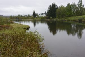
In 1262 AD the Norwegian King took control of Iceland and introduced Christianity to Icelanders. This church at Thingvellir was established in 1867 and was operated until 2016. Today it marks a historic site for the people that settled in this region.

Pa-hoe hoe lava flows

On our way back we got lost and ended up trekking through the rift valley where pa-hoe hoe lava flows were observed on trails that cut through thick moss beds and shrub brush.

Sitting in a secondary rift zone

Part of getting lost is finding really cool formations. Here I’m sitting in a secondary rift zone where columnar basalt’s are observed to have formed in the center of the rift zone.After re-orienting ourselves we managed to find our van and head east to the the town of Geysir, a site of hydro-thermal activity where hot springs and geysers were observed.

Stop 2: Geysir and Strokkur

Here a hot spring is observed with steam rising from it’s boiling waters as well as the precipitation of white minerals (sinter) formed from high concentrations of silica within the fluids and red minerals formed from iron oxidation.


Myles discusses how geothermal vents, and geysers are indicators of the precipitation of low sulphide gold and silver mineralization. However, these systems appear too young to have had the opportunity to form these minerals.


Here is the Strokkur geysir  putting on a spectacular display, faithfully erupting every 5-10 minutes.  https://viuvideos.viu.ca/media/Strokkur+Geyser%2C+Iceland/0_umskoyas

After spending some time admiring the hydrothermal springs and Geysir Strokkur we decided to continue to the east.

Stop 3: Gullfoss

The falls of Gullfoss were impressive and much larger than we imagined. At one time the falls were to be leased for power generation but the deal fell through and ever since the area has been a protected park.


Here Tim sizes up the massive waterfall and contemplates the faults that make up the multiple steps that redirect it’s flow.


A better view, and the scale of this massive water fall becomes apparent. The falls appear to be directed by a major fault intersected by secondary fault that changes the direction of the flow. The lower section of the water fall is later directed into a large rift zone.

What we learned today was that the scale of the Western Rift Zone is locally very complex and not as simple to understand than it first appeared.


Day 1 Reykjanes Peninsula!

After rallying the students in Rekyavik, it was time to head south to the fresh volcanic landscape of the Reykjanes. Immediately upon leaving Reykavik, we were surrounded by rugged volcanic features ranging from 0.8 million years old to just 600 years old.

Example of a typical volcanic landscape in Iceland.

The first scheduled stop was at Lake Kleifarvatn, Iceland’s deepest lake. Although not visible without diving, there are geothermal vents at the bottom of the lake.

The students, and our trusty van with Lake Kleifarvatn in the background.

While the lake might transfix your average person, we immediately ran off to the west side of the lake to an outcrop of cemented volcanic ash with muddy layers.

Volcanic ash layers on the side of the road.

Further south, we observed the geothermal area of Krysuvic. This area featured radically altered landscapes due to the interaction of heat and water with the rocks. The heat and water have changed the appearance of the rock from black to a variety of vibrant colours such as yellow, white, red, and orange.

Students examine the geothermal steam, hot springs and various coloured minerals.
Tim gazes at the various brightly-coloured minerals of the Krysuvik hot springs.

The group then carried on down the southern coast of the Reykjanes peninsula, eventually arriving at another geothermal site, called the Gunnuhver Hot Springs. This site is near a geothermal power plant where the steam is used to produce electricity for Iceland.

Toby walking up to the steaming Gunnuhver hot spring area.
A view of the geothermal system with the hot springs and a geothermal power station to the left.
Another example of geothermal minerals at Gunnuhver Hot Springs.

Our last stop for the day was the location of the spreading apart of the North American Tectonic Plate and the Eurasian Tectonic Plate. This is one of the few places where this spreading can be observed because the vast majority of the rift is located on the bottom of the ocean.

Tim geologizing by the North American Plate boundary. The Eurasian plate can be observed on the opposite side, on the right side of the picture.
Payton wandering between the continents.

We then ended our day in the town of Selfoss, where we’ll begin our trip to the Golden Triangle tomorrow!

GEOL 390 Class is Off to Explore Iceland’s Geology

VIU’s intrepid GEOL 390 class are on a field trip to explore the geology of Iceland and will be reporting their daily activities using this blog.  The plan, over the next ten days, is to travel to most regions of Iceland and examine the wide range of geological phenomena: from fissure swarms, volcanic centres to glaciers.  Of special interest will be the amazing interaction between glaciers and  active volcanism that can result in features such as mobergs ridges and large outwash events or jokulhaups.

Iceland is a geological unique place in the world, whereby a mid-oceanic ridge (a spreading centre where two plates are moving apart) occurs in the same place as a mantle plume or hot spot.  The combination of these two results in an upwelling of magma material that forms a large island – Iceland.  Iceland, which is 400 km by 500 km with elevations of up to 3000 m, is geologically very young – only 24 million years old.  (Much younger than the last terrane which collided and joined onto the southwest coast of Vancouver Island 40 million years ago).

Iceland is seismically and volcanically very active, and connects two spreading segments of the Mid-Atlantic Ridge as shown on the tectonic map– the Reykjanes segment to the southwest of Iceland and the Kolbeinsey segment to the north.  The link between these two spreading segments crosses the land of Iceland.  This is not a simple connection, but is rather a complex arrangement of rift (pull apart) zones with fissure swarms and volcanic centers, that are separated by sliding transform fracture zones.  Many of these volcanic centers occur near to the current location of the mantle plume.  The result of this intense volcanic activity are numerous geothermal areas, some of which we plan to explore and hopefully immerse ourselves in occasionally – thermal swimming pools.

From the topographic map, it is possible to see the real extent of Iceland from the highland area with glaciers in the centre of the island, leading down to the ford lands and the lowlands along the coast, all related to extensive glacial erosion and outwash events.

Our first day will be along the Reykjanes Peninsula to the southwest, from where we will travel along the South Road to the eastern side of Iceland.  From here we will return to the Westman Island (a short ferry ride), and then travel to the northwest and the Snaefellsness Peninsula, eventually ending up in the north of Iceland and Akueyri and Lake Myvatn, close to the Arctic Circle. It is then a short journey back to Reykjavik!  All to be done in 10 days – no way near enough time.  Long daylight hours will help, but cooler (5-15C) and wetter weather might be a challenge!