Day 10 Return to Reyjavik

The last day of the GEOL 390 field trip to Iceland was to be a long day’s drive back from Akureyri in the north to Reykjavik in the south, a total of 385 km.  This was to be through some of the ‘less geologically exciting’ parts of Iceland, but as usual we had some surprises.

The day started well with sun at last and a cool 6-7 C.  The bus was loaded and ready for a later departure than usual at 10 am.  Fours stops were planned along the route based on our reconnaissance of the road during Day 8.

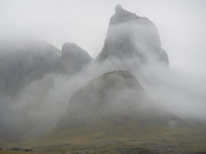
The first stop was to examine some jagged mountain peaks from the road, that were distinctly different from the table top plateaus of the Tertiary basalts – likely scrapped flat during a number of previous glacial.   These jagged peaks corresponded to some rhyolite extrusives on the geology map.  However, with the fog low on the mountains and the driver focused on the road the site was completely missed!  Something for next time.
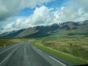
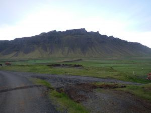
The level ‘table top’ mountains formed by glacial erosion of Tertiary basalts

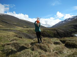
The second stop was to examine a sedimentary lignite layer (a precursor to coal) that is clearly shown on the Iceland geology maps as black lines within the Tertiary basalts.  This layers marks a geological unconformity and a period of  a warmer climate and vegetation growth.  The most likely looking site was a steeper river canyon where we had spotted some red layering previously.  We found a good road pullout for a 10 minute stop, which as usual turned into 45 minutes!  While the students went off to check out some of the red layering, Tim chatted with some tourists (a drone operator and his wife) to see if they would photograph the layers for us on the other side of the canyon.  They did so and promised to send photos later.  From some samples that were collected it was deduced that the red laying was a red sandstone marking a distinct period of sediment deposition between volcanic events.  No sign of lignite.  (A later discussion with a local geologist indicated that this layer was typically very difficult to locate, as it easily erodes away.)
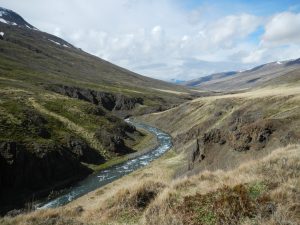
Examine the red layers within the Tertiary basalts


Capturing the drone

The drive continued south thought some amazing upland valleys, past the ends of fiords and along the edges of large braided rivers.  We eventually arrived at the third stop a series of two almost perfect scoria cones with recent basalt lava flows emanating from their craters, both that had been breached.  This was a national monument with a well-developed trail system and some excellent explanation boards. ( A distinct contrast to the previous days in Lake Myvatn area, where tourist infrastructure was definitely missing in the mud pools.)  The sun was out, the breeze was blowing and the sights amazing – Iceland at its best.
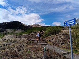
The climb up to the scoria cone

After a quick stop in Borgannes, it was on to the last leg of the journey through the 6 km and 1000 krone ($14) toll tunnel to the last stop – a series of sub vertical dikes in a sequence of Pleistocene lavas.  A quick race to the dykes up a steep slope by two volunteers confirmed the composition of dikes as mafic and the surrounding basalts flows with column structures.
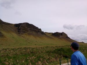
Mafic dykes in slopes on south side of tunnel

A short drive, before arriving in Reykjavik and the search for the City Hostel located near the Iceland International soccer field, a large camping site and of course the geothermally heated swimming pool.  Dinner at the local fish restaurant include: burgers, one whale steak, haddock and shrimp.  A night out for some to see the late (or early) 1-5 am nightlife of downtown Reykjavik and a dip in the swimming pool for others.
The comfy bus ride ends?

The trip is at an end with some flying out the next day, others staying one more night and one staying in  Iceland 10 more days to see more.  What a great way to spend 10 days in the field with  some of the most active geology in the world.  Looking forward to the next visit to Iceland already!
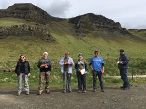
The Iceland Team of eight. Note, the two way up the slope near the bedrock bluffs and dykes.

Day 4 Stokeness and Helvar: Searching for Rocks other than Basalt!

Today’s adventure lead us to areas near Hofn on the southeast side of Iceland. We were hoping to encounter some rocks other than basalt – which makes up over 85% of the island.  We were as usual surprised by what we found.

Our day started with the usual cool, fog and light rain.  On our approach to Stokesnes we decided to examine some of the oldest (Tertiary) rocks on Iceland – thickly layered basalt flows.

The oldest rocks in Iceland – Tertiary basalts

We clambered up a gully to the base of a small waterfall and found a series of layered basalt flows, separated by a thin shale bed and a thicker conglomerate bed below.  This confirmed what we saw on the map legend that mentioned inter-bedded sediments, and also the bluffs themselves with the basalt layering highlighted by the more recessive sediments.

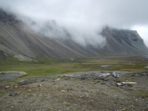
The amphitheatre-like landscape at Stokeness.  The setting for the Viking camp

It did not take long to arrive at Stokeness – a peninsula surround on both sites by elongate spits and interesting lagoons.  After paying to enter the area (that is part of a private farm) we hiked into an amphitheatre-like setting where high mountains and bluffs with steep scree slopes leading down to a grass and wetland area adjacent to the lagoon.  At the base of the slope we checked out a mock Viking encampment that had been constructed in the 1990’s for a movie set, but never used.  A good discussion of how a Viking must have lived ensued.

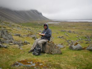
Aaron apturing notes during a field lunch break

From scree slopes and nearby outcrops we encountered a combination of intrusive rocks – diorite, gabbro and a possibly a quartz diorite?  There was some suggestion that these intrusives were emplaced into each other, but their relationship to the surrounding and oldest rocks of Iceland – the Tertiary Basalts was still a but if a mystery.  However, from looking at the bluffs on the access road to Stokeness we did view a conclusive instructive contact between these basalts and the quartz diorite.

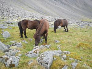
Friendly locals!

Part of our hike took us through group of five of Iceland horses who seemed friendly enough and were willing to be petted – even by Alex.  However, we decided not to share our lunch as the rest of the herd of thirty might have joined us.

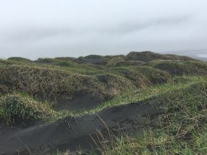
Black sand dunes at Stokeness

Before leaving Stokenss, we examined the shoreline (near an old US Radar station) and encountered some more gabbro outcrops with some amazing coarsely crystalline pegmatite pods.  We also found some black sand dunes, where sand from the beach was swept up to edge of the lagoon.  There was some discussion as to wind direction and the asymmetrical shape of the dunes, which appeared vegetated on the windward site.

Intrusive rocks at Helvar

To finish the day we decided to head a little further east towards another headland at Helevar, where a second intrusive complex was reported to occur.  This started to appear to be less interesting as sometimes happens in geology.  However, we moved a little further along the road and suddenly encountered a series of spectacular outcrops in the middle on a black sand plain.  On closer inspection we found that we were at the contact between a gabbro and a quartz-diorite intrusives with xenoliths and cross-cutting veins (described by one member of the group as a ‘Dalmatian Explosion’).  Finished for the day we headed back to our hostel for the evening that appeared to full of people from all over the world – China, Israel, Germany and Vancouver Island (UVic students)!

GEOL 390 Class is Off to Explore Iceland’s Geology

VIU’s intrepid GEOL 390 class are on a field trip to explore the geology of Iceland and will be reporting their daily activities using this blog.  The plan, over the next ten days, is to travel to most regions of Iceland and examine the wide range of geological phenomena: from fissure swarms, volcanic centres to glaciers.  Of special interest will be the amazing interaction between glaciers and  active volcanism that can result in features such as mobergs ridges and large outwash events or jokulhaups.

Iceland is a geological unique place in the world, whereby a mid-oceanic ridge (a spreading centre where two plates are moving apart) occurs in the same place as a mantle plume or hot spot.  The combination of these two results in an upwelling of magma material that forms a large island – Iceland.  Iceland, which is 400 km by 500 km with elevations of up to 3000 m, is geologically very young – only 24 million years old.  (Much younger than the last terrane which collided and joined onto the southwest coast of Vancouver Island 40 million years ago).

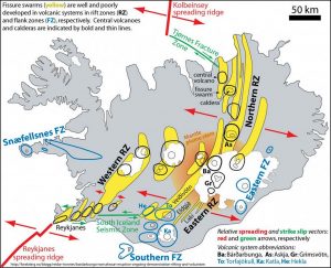
Iceland is seismically and volcanically very active, and connects two spreading segments of the Mid-Atlantic Ridge as shown on the tectonic map– the Reykjanes segment to the southwest of Iceland and the Kolbeinsey segment to the north.  The link between these two spreading segments crosses the land of Iceland.  This is not a simple connection, but is rather a complex arrangement of rift (pull apart) zones with fissure swarms and volcanic centers, that are separated by sliding transform fracture zones.  Many of these volcanic centers occur near to the current location of the mantle plume.  The result of this intense volcanic activity are numerous geothermal areas, some of which we plan to explore and hopefully immerse ourselves in occasionally – thermal swimming pools.

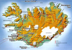
From the topographic map, it is possible to see the real extent of Iceland from the highland area with glaciers in the centre of the island, leading down to the ford lands and the lowlands along the coast, all related to extensive glacial erosion and outwash events.

Our first day will be along the Reykjanes Peninsula to the southwest, from where we will travel along the South Road to the eastern side of Iceland.  From here we will return to the Westman Island (a short ferry ride), and then travel to the northwest and the Snaefellsness Peninsula, eventually ending up in the north of Iceland and Akueyri and Lake Myvatn, close to the Arctic Circle. It is then a short journey back to Reykjavik!  All to be done in 10 days – no way near enough time.  Long daylight hours will help, but cooler (5-15C) and wetter weather might be a challenge!