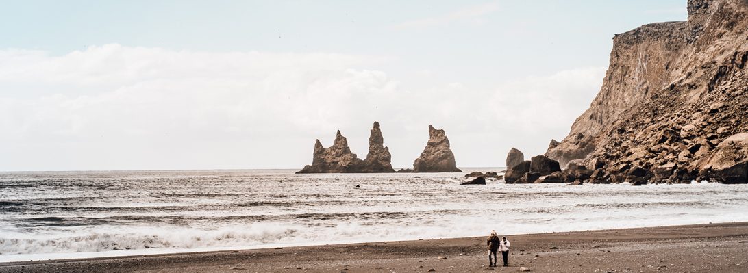
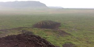
Snaefellsnes Peninsula is the area where Icelanders have their vacations, and the area is a geological smorgasbord. Unlike the rest of Iceland’s black sand basalt beaches, here the sands are often white and golden, indicative of their felsic (andesite and rhyolite) origins. However we decided to cut short our Snaefellsnes leg because we had a long 5-hour journey north. There is only so much driving Tim should be doing every day, and arriving at base camp at midnight doesn’t leave enough time to eat and dry out the clothes and gear. Darkness however is never an issue, because there is 24-hour light, so it is easy to lose track of time. The previous night we decided to limit Snaefellsnes to only Myrar in the morning, which is on the southeast approach to the peninsula. Fortunately, there sits Eldborg crater, the finest example of a spatter cone in Iceland.
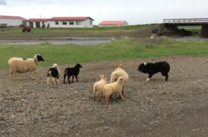
Before the morning hike starts, our sheepfarmer host treats us to a sheep dog instructional session for a young pup. Highly entertaining. This young dog was every bit as energetic and determined as many in our young crew. Sheep are as omnipresent in Iceland as lava. There are also herds of domestic horses, but no cattle. Icelanders eat mutton, lamb, fish and horse. All are on the menu. Beef is rare. Vegetables are imported, although the geothermal presence is making some greenhouses viable up here at the Arctic Circle.
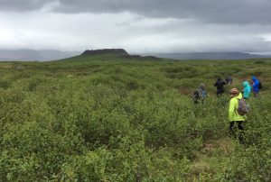
The hike is about an hour through birch bushes growing on a lava field. Eldborg is 5000 years old, almost a perfect ellipsoid, 180m X 250 m, 50 m high, with a steep 40 – 60 degree slope.
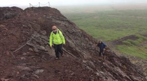
The entire hike is across one of Iceland’s many lava fields. Actually, Iceland is one big lava field, which is only occasionally covered with enough sediments to create a soil, which if thick enough, creates the incredibly fertile agricultural base for which volcanoes are famous. Here the lava field varies between aa lava (blocky, chunky, jagged) further out, and pahoehoe lava (smooth, ropy, braided) closer in. Both types made excellent stair material for our climb up.
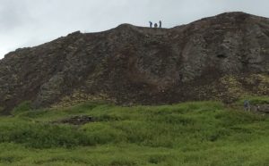
That lead group is almost always Payton, Alex, Myles and Toby. This picture is three of those four, although the fourth has got to be in there somewhere. Our spatter cone is the biggest in a sequence of five that aligns east-west, the same alignment as the en echelon fissure zones of the Snaefellsness peninsula.
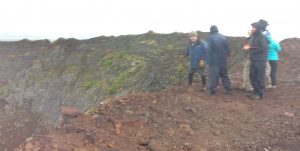
Tim usually gets it right, but one thing geologists like to do as much as looking at rocks, is to argue about rocks, so opinions, opposition and alternative explanations are always welcome. The rain is absolutely pouring here, and the wind is blowing hard.
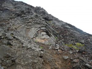
The center crater of the spatter cone was a lava lake, and the bubbling and splashing would lap the edges, leaving a series of lava layers on the sides of the cone. Myles commented that this process creates the same appearance as the very different exfoliation of granite.
This is a cinder cone adjacent to our spatter cone to the SSE. The cinder cone also has a central vent (sometimes large enough to be a caldera). The cinder cone tephras (ash and rocks ejected by the volcanic vent in the centre) are here smaller, lighter, and more vesicular (riddled with holes) than the tephra at the top of our spatter cone.
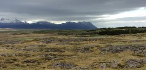
Now we have returned to Borgarnes and are heading off on our big trip north. Here we have the Borgarfjordur anticline. Notice how the tree-lined ridge in the middle distance slopes steadily to the left (east). This represents the eastern limb of the anticline.
Similar to Hawaii, Iceland is formed by a mantle hot-spot. However in Iceland’s case, the mantle hot-spot intersects the Mid-Atlantic Ridge, where the oceanic bottom spreads apart in a rift, an underwater volcanic chain, where ~ 90% of the world’s volcanoes exist. Iceland is composed of a series of rifts, some active, others inactive or extinct. On Iceland, these rifts form large rift zones which jump eastward 100 – 200 km every few million years. The hot spot is relatively stationary, but the plates move, so the rift zones migrate east. The hotspot center is currently under Vatnajokull, the great ice sheet in eastern Iceland. The Borgarfjordur anticline is important because it is the high ground between two rift zones, which confirms the location of a rift jump.
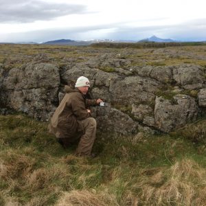
Toby’s project is studying the timing of these rift jumps (by analyzing rock ages and locations of rifts zones). Here Toby is checking the location, dip (slope), and direction of a rift jump. Toby is showing perfect posture for this task – notice the straight spine and the deep crouch.
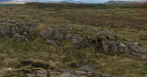
Callie commented on a previous blog that geologists love rocks and that is very true. Here Toby is indulging in his vocation, studying a rock. Toby is not actually wearing camouflage, but is rather undergoing the initial stages of lithification, whereby everything on the earth’s surface, including Toby, eventually turns back into rock. Of course, when we see this we always interrupt the process, but really we are only deferring the inevitable for some later time.